What is recorded here
No visible wall, no broken stone, no marker at all. The land itself is the monument. The ring appears only when the sky looks down, not when a person walks past. Coolaha keeps its shape in shadow and distance while deception the earth resists human certainty.
Located towards the bottom of the N-facing slope of a drumlin. It is depicted as an embanked enclosure (ext. diam. c. 30m) described in gothic lettering as a ‘fort’ only on the 1834 edition of the OS 6-inch map. No archaeological feature was visible at ground level in a cereal crop in 1984, but traces of an enclosure defined by two fosse features (ext. diam. c. 45) can be seen on the OSI series of images (1995).
The above description is derived from the published 'Archaeological Inventory of County Monaghan' (Dublin: Stationery Office, 1986). In certain instances the entries have been revised and updated in the light of recent research.
Date of revision: 31 July 2017
The monument record does not grant public access. Check the route and ask the landowner before entering private land.
- What survives
- Recorded monument
Places near here
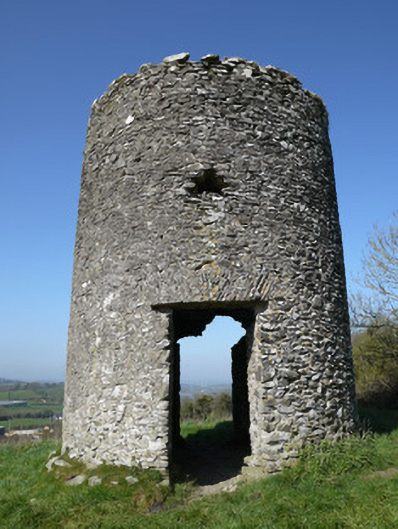 mill (wind)mill (wind) · 481 yd
 Ballymackney Church (Killanny)church/chapel · 505 yd
 Promontory fortPromontory fort, inland · 1.1 mi
 CastleCastle, motte and bailey · 1.2 mi
 Man-made underground passage in TrostanMan-made underground passage · 1.3 mi
 Flat cemetery in AnnaheanFlat cemetery · 2.9 mi
 Monkey-puzzleMonkey-puzzle · 3.1 mi
 European BeechEuropean Beech · 3.1 mi
 Mannan Castle (in ruins)Castle, Anglo-Norman masonry castle · 3.5 mi
 TobernagalliaghSpring · 4.8 mi
 BarleyhillMountain / peak · 5.6 mi
 Ballsmill Amenity LandPicnic place · 9.6 mi