What is recorded here
Fairy fort / earthen ringfort in Ballyguyroe South is a subcircular earthen enclosure in County Cork pasture, measured 76 metres north-south and 68 metres east-west, with a widened northwest entrance and a possible early ecclesiastical enclosure about 90 metres west. Its shallow bank and partial fosse suggest an old boundary rather than a grand fortress, yet the name fairy fort preserves the local habit of giving unusual places a living identity. People may have pastured, hidden, worshipped or simply avoided the slope, while the earth kept its shape through forgetting.
In pasture, on NE-facing slope. Subcircular area (76m N-S; 68m E-W) enclosed by earthen bank (int. H 0.2m; ext. H 0.3m); external fosse (max. D 1.1m) ENE->S, shallow depression elsewhere. Modern break in bank to ENE; entrance to NW, widened. Possible early ecclesiastical enclosure (CO018-032---) c. 90m to W.
The above description is derived from the published 'Archaeological Inventory of County Cork. Volume 4: North Cork' (Dublin: Stationery Office, 2000). In certain instances the entries have been revised and updated in the light of recent research.
Date of upload/revision: 14 January 2009
The monument record does not grant public access. Check the route and ask the landowner before entering private land.
- What survives
- Recorded monument
Places near here
 IndicatedEcclesiastical enclosure · 185 yd
 Horse Field WoodForest · 545 yd
 Mary Frasier'sArchaeological place · 630 yd
 North Meadow WoodForest · 797 yd
 Farahy Schoolschool · 821 yd
 Bowen's Courtgates/railings/walls · 1112 yd
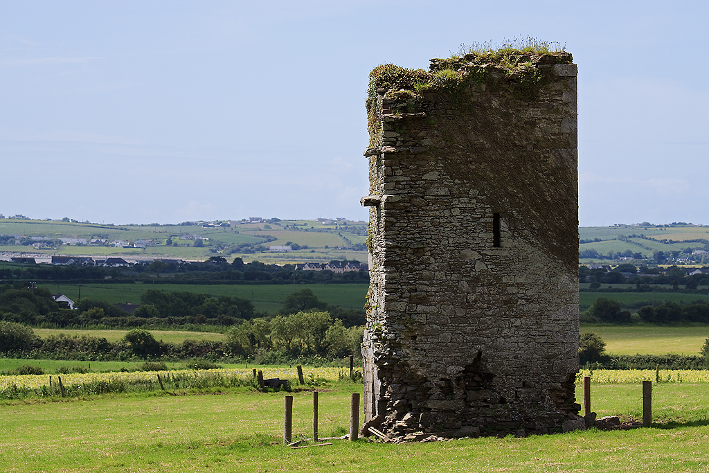 Farahy Castle (in Ruins)Castle, unclassified · 1518 yd
 Shanagh Castle (Site of)Castle, unclassified · 1.5 mi
 Flat cemetery in Ballyenahan NorthFlat cemetery · 2.9 mi
 Coolfree MountainMountain / peak · 3.4 mi
 Anne's Grove GardensHeritage attraction · 3.5 mi
 CarrigeenamronetyMountain / peak · 3.7 mi