What is recorded here
Fairy fort / earthen ringfort in Ballinure is a fairy fort or earthen ringfort in Ballinure, County Tipperary, Ireland. It occupies a low hillock in an upland area with panoramic views from west through north to east. The circular site measures 26 metres north-south and 27 metres east-west inside an earth and stone bank that stands 2.5 metres high externally. A causewayed entrance cuts through the north side, while an outer bank remains visible from south through east to north before levelling elsewhere.
On top of low hillock in upland area under grass with good panoramic views from W through N to E. Impressive raised circular area (int. diam. 26m N-S; 27m E-W) enclosed by an earth and stone bank (top Wth 2.4m; base Wth 4m; int. H 0.7-1m; ext. H 2.5m), fosse (base Wth 3-4m; top Wth 6m; ext. D 0.6m) and outer bank (top Wth 1.6m; base Wth 2m; ext. H 0.3m) visible from S though E to N elsewhere it has been levelled. Causewayed entrance at N (Wth 2.3m). Field boundary indicated on latest ed. OS 6-inch map which intersects ringfort at N through E has been removed. The outer bank may be just an 18th/19th-century field boundary enclosing the ringfort as indicated on first ed. OS 6-inch map.
Compiled by: Jean Farrelly
Date of upload: 26 August 2011
This remains an important historical record, but the official description says the monument is no longer visible or has been destroyed. The monument record does not grant public access. Check the route and ask the landowner before entering private land.
- What survives
- No visible remains or recorded as destroyed
Places near here
 IndicatedFairy fort / earthen ringfort · 394 yd
 Taylor's WoodWood · 710 yd
 Noan WoodWood · 964 yd
 Hilltop enclosure in Ballaghboy (graystown Par.)Hilltop enclosure · 1043 yd
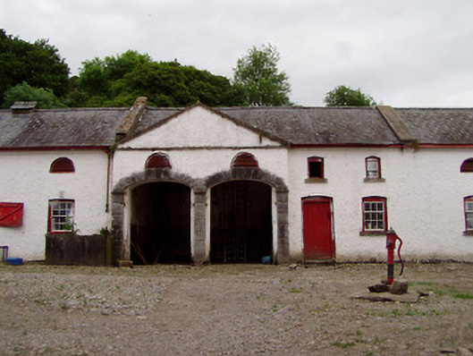 Noan Housefarmyard complex · 1103 yd
 Church in RuinsChurch · 1200 yd
 Ballinure HillMountain / peak · 1608 yd
 Castle in RuinsCastle, motte and bailey · 1.8 mi
 The GarrisonCastle, tower house · 2.0 mi
 Gobban Saer's GraveArchaeological place · 3.4 mi
 Slieveardagh Heritage CentreVisitor information · 4.1 mi
 Horse and JockeyVisitor information · 4.1 mi