What is recorded here
Fairy forts like this one in County Limerick mark ancient boundary and belief. The ring measures twenty-seven metres across, with an earthen bank, outer ditch and a small quarry scar inside. Cattle still walk through the place, wearing the old edge while trees hold the top. What the ring kept out, or kept together, has stopped answering, but the shape still answers back.
In pasture, on slight S-facing slope. Circular area (diam. 27m) enclosed by earthen bank (int. H 0.7m; ext. H 1.35m) with external fosse (D 0.8m; Wth 1.2m). Bank is covered by trees and bushes and eroded by cattle accessing interior. Stone facing on outer face of bank similar to facing on surrounding boundary wall which abuts outer edge of fosse at E; aerial photograph (ASIAP) taken in 2002 shows this boundary has been removed. Depression on N side of interior probably remains of small quarry. Interior level and under pasture though partially covered by trees.
Compiled by: Denis Power
Date of upload: 26 August 2011
See attached ASI aerial photograph ASIAP – 323/16 on 05/10/2002.
This remains an important historical record, but the official description says the monument is no longer visible or has been destroyed. The monument record does not grant public access. Check the route and ask the landowner before entering private land.
- What survives
- No visible remains or recorded as destroyed
Places near here
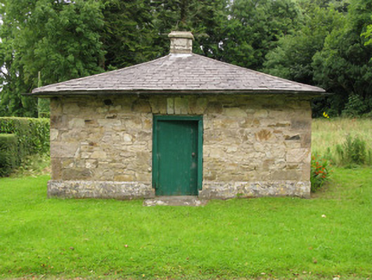 Heathfield Housegate lodge · 301 yd
 IndicatedFairy fort / earthen ringfort · 1208 yd
 CastleCastle, unclassified · 1579 yd
 Church (in ruins)Church · 1702 yd
 BarrowBarrow, ring-barrow · 1709 yd
 Garbally WellSpring · 1.8 mi
 Mayne Ho.Castle, unclassified · 2.5 mi
 Sunday WellSpring · 2.6 mi
 Famine stoneMemorial · 4.8 mi
 KnockfeerinaMountain / peak · 5.2 mi
 European ashEuropean ash · 5.3 mi
 National Co-op MuseumMuseum · 5.6 mi