What is recorded here
Fairy fort in Ballindeenisk, County Cork, a circular earthwork thirty-three metres across with a one-and-a-half-metre bank and a two-metre gap to the north-northwest, standing in pasture on a south-southwest-facing slope. Its interior is level and planted with pine and deciduous trees, while the bank has been incorporated into a field fence running north-northwest to south-east. The incline towards the bank traces the line of a fosse from south-west to north-northwest, suggesting the ring once kept something out or held something within. Whether it marked a homestead, a boundary or a place set apart for story, the shape still reads as a deliberate circle on living land.
In pasture on SSW-facing slope. Circular area (33m N-S; 33m E-W) defined byearthen bank (H 1.4m), incorporated into field fence NNW->SE; incline towards bank traces line of fosse SW->NNW. Gap (Wth 2m) to NNW. Interior level, planted with pine and deciduous trees.
The above description is derived from the published 'Archaeological Inventory of County Cork. Volume 2: East and South Cork' (Dublin: Stationery Office, 1994). In certain instances the entries have been revised and updated in the light of recent research.
Date of upload/revision: 14 January 2009
The monument record does not grant public access. Check the route and ask the landowner before entering private land.
- What survives
- Recorded monument
Places near here
 Enclosure in Ballinlegane (barrymore By.)Enclosure · 578 yd
 IndicatedFairy fort / earthen ringfort · 968 yd
 Castle (Site of)Castle, unclassified · 1467 yd
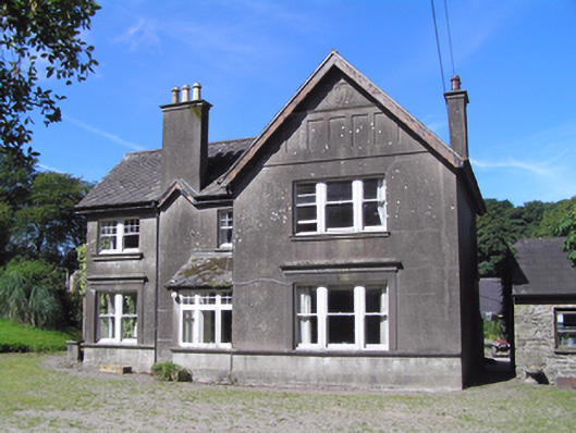 Ballindeenisk Househouse · 1480 yd
 kilnkiln · 1.1 mi
 Sarsfields Court (in Ruins)Castle, unclassified · 3.1 mi
 Graveyard in Killuntin NorthGraveyard · 3.4 mi
 Gleeson MemorialMemorial · 3.4 mi
 Moanbaun ForestForest · 4.0 mi
 Devonshire's HillMountain / peak · 4.8 mi
 Carberrytown WoodWood · 4.8 mi
 Murphy's RockViewpoint · 5.8 mi