What is recorded here
Fairy fort / earthen ringfort in Arbourhill (Magorban parish), woodhouse is a fairy fort or earthen ringfort in Arbourhill (Magorban parish), woodhouse, County Tipperary, Ireland. It occupies the crest of a broad, flat ridge in gently undulating terrain, now covered by pasture. A roughly circular area 32.4 metres north-south and 31 metres east-west is defined by a broad, flattened bank 13 to 17.8 metres wide and an outer ditch 4.5 metres wide. A 4.4-metre gap appears in the south-southeast quadrant, while a slight suggestion of an outer bank remains in the south quadrant.
On crest of broad, flat ridge in gently undulating terrain, under pasture. Public road running roughly E-W, kinks to avoid the N edge of the monument. Roughly circular area (diam. 32.4m N-S; 31m E-W) defined by broad, flattened bank (Wth 13-17.8m; int. H 0.19-0.28m; ext. H 0.75m) and outer fosse (Wth 4.5m; D 0.16m). Gap (Wth 4.4m) in SSE quadrant. Slight suggestion of an outer bank in the S quadrant. An out of commission ESB pole is located on the bank in the NW quadrant.
Compiled by: Jean Farrelly
Date of upload: 26 August 2011
The monument record does not grant public access. Check the route and ask the landowner before entering private land.
- What survives
- Recorded monument
Places near here
 Concentric enclosure in WoodhouseConcentric enclosure · 366 yd
 MonumentArchaeological place · 367 yd
 Arbourhill Ho.House, 17th century · 509 yd
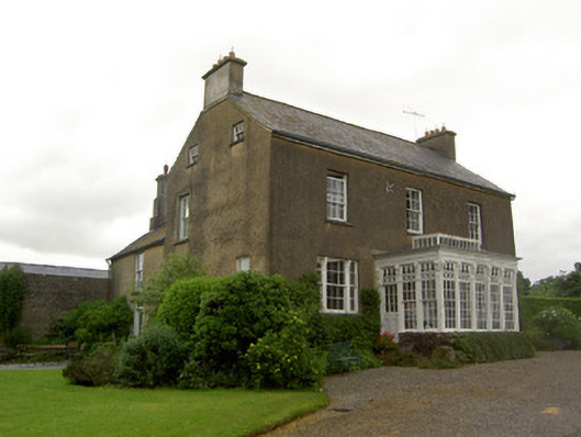 Beechmount Househouse · 734 yd
 CastleCastle, ringwork · 1002 yd
 Bawn in Ballyvadin (magorban Par.)Bawn · 1.6 mi
 Taylor's WoodWood · 2.4 mi
 Noan WoodWood · 2.4 mi
 Ballinure HillMountain / peak · 2.8 mi
 Kilknockan HillMountain / peak · 3.9 mi
 East GateMemorial · 4.7 mi
 Hore AbbeyHeritage attraction · 6.4 mi