What is recorded here
Half a ring of earth and grass still stands on the drumlin slope in Aghameeny, cut clean through by the road that now crosses it. The missing half may have been a home, a boundary marker, or a place people avoided because it belonged to someone else. What remains is large enough to walk across and quiet enough to forget until the line of the road appears in the grass.
Located towards the top of the S-facing slope of a drumlin. It is represented only on the 1945 revision of the OS 6-inch map as a D-shaped hachured feature truncated by a roadway at E. This is a grass and rush-covered D-shaped platform (dims 29m NW-SE; 13m NE-SW) defined by a scarp (H 0.45m at NW to 0.8m at SE) SE-W-NW, and an outer berm (Wth 2-3m) S-SW which may be the remains of an external fosse. ANW-SE road truncates the monument at NE and there is no evidence of it NE of the road.
The above description is derived from 'The Archaeological Inventory of County Leitrim' compiled by Michael J. Moore (Dublin: Stationery Office, 2003). In certain instances the entries have been revised and updated in the light of recent research.
Compiled by: Michael Moore
Date of revised upload: 15 October 2019
The monument record does not grant public access. Check the route and ask the landowner before entering private land.
- What survives
- Recorded monument
Places near here
 CastlecarraCastle, unclassified · 256 yd
 IndicatedFairy fort / earthen ringfort · 508 yd
 Enclosure in CloonmulliganEnclosure · 523 yd
 R. C. ChapelChurch · 1491 yd
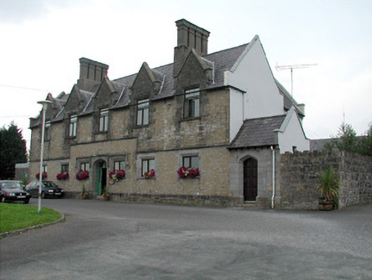 Summerhill Lodgeworkhouse administration block · 1557 yd
 Moon RiverHeritage attraction · 1.5 mi
 PortCastle, unclassified · 1.7 mi
 Patrick Gill Memorial Plaque (IRA)Monument · 3.1 mi
 Declaration of IndependenceMemorial · 3.1 mi
 Wildlife AreaNature reserve · 3.4 mi
 Leabaidh DermotCave · 3.4 mi
 Hughestown WoodForest · 3.5 mi