What is recorded here
From the Irish Caves Database, University of Bristol Spelæological Society record 1563
Places near here
Picture notes
- Computer-made picture. It does not show this holy well.
- Computer-made picture. It does not show this monument.
- Computer-made picture. It does not show this walking route.
- Drow69, Wikimedia Commons · CC BY-SA 3.0
- Mike Searle, Wikimedia Commons · Creative Commons Attribution-ShareAlike 2.0
- P L Chadwick, Geograph · Creative Commons Attribution-ShareAlike 2.0
- Computer-made picture. It does not show this mountain top.
- Mac McCarron, Geograph · CC BY-SA 2.0
- The Banner, Wikimedia Commons · CC BY-SA 3.0
- AndyCorbley, Wikimedia Commons · CC BY-SA 4.0
 TobernafiaghantaHoly well · 384 ydComputer-made picture
Explorer Tom Tobernafiaghanta in Termon is the Well of the Hunters, so don't bring your best trousers if you think they're tracking you. It's a tiny hollow, barely big enough for a squirrel's ambition. Visit, then text me what you think. I'll pretend to read it.
 Fulacht fia in Fahee NorthFulacht fia · 456 ydComputer-made picture
Explorer Tom Here is a Fulacht fia in Fahee North where the wind keeps picking on it because it can’t reach. I swear the breeze is jealous of how well-preserved it is compared to my hair. Toast it with a cup of tea and move on to the next one.
 Hut site in Fahee NorthHut site · 479 ydComputer-made picture
Explorer Tom This Hut site in Fahee North is so hidden I think the Vikings got lost looking for it and ended up in Dublin by mistake. It’s tucked into a hollow where only bad decisions lead. Grand place for a sulk or a snog, your call, just don’t blame me if you’re stuck there.
 Carran LoopWalking route · 1531 ydComputer-made picture
Explorer Tom Carran Loop in County Clare sounds short and sweet! Perfect for a quick wander before dinner. Don't overthink it, just go with the flow, mate.
 Templecronan (in ruins)Church · 1630 yd
Explorer Tom Templecronan survived a storm that broke the local boatman’s back, and it just shrugged it off. The cyclopean masonry is thick enough to block out bad news. Stand there long enough and someone will ask if you're lost.
_-_geograph.org.uk_-_4570444.jpg/250px-Castles_of_Munster,_Cappagh,_Clare_(1)_-_geograph.org.uk_-_4570444.jpg "Photo: Mike Searle, Wikimedia Commons · Creative Commons Attribution-ShareAlike 2.0") Cappagh CastleCastle · 1.2 mi
Cappagh CastleCastle · 1.2 miExplorer Tom Cappagh Castle rises as a tall stone ruin in open rocky grassland, standing firm under the cloudy sky of County Clare.
 Saint Columba's Catholic ChurchChurch/chapel · 1.7 mi
Explorer Tom Saint Columba's Catholic Church in Crughwill is basically the village's living room, just with better lighting and more judgmental stares. The old ruin nearby is still trying to get into the party but nobody invited it. Hum something sad nearby; it adds atmosphere for the dramatics.
 Gortaclare MountainMountain / peak · 1.9 miComputer-made picture
Explorer Tom Gortaclare Mountain is a rugged presence in the hills, its summit marked by the enduring strength of the land it guards.
 Castle in ruinsCastle, tower house · 2.0 mi
Explorer Tom Castle in ruins near Carran Turlough is secretly proud of the potato growing next to its foundation because the castle is doing worse. It controls a routeway but mostly just controls your sense of direction. Pretend it's yours and plan the housewarming.
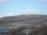 Burren National ParkNature reserve · 2.1 mi
Explorer Tom Burren National Park is a landscape like no other, with its rocky karst terrain stretching out under the wide, open sky of County Clare.
 KnockanesMountain / peak · 2.4 miComputer-made picture
Explorer Tom Oh, Knockanes! A rugged peak in County Clare that's as mysterious as the map says it is.
 Gleninshing portal tombHeritage attraction · 4.7 mi
Explorer Tom Gleninshing portal tomb is a sacred site where ancient traditions and heritage are honored in County Clare.
More caves in County Clare · All of County Clare

What do you know about this place?Tap to add a comment or ask a question