
Places near here
Photo credits
- Drow69, Wikimedia Commons · CC BY-SA 3.0
- Gordon Hatton, Geograph · Creative Commons Attribution-ShareAlike 2.0
- Mike Searle, Wikimedia Commons · Creative Commons Attribution-ShareAlike 2.0
- Mac McCarron, Geograph · Creative Commons Attribution-ShareAlike 2.0
- P L Chadwick, Geograph · Creative Commons Attribution-ShareAlike 2.0
- Mac McCarron, Geograph · CC BY-SA 2.0
- The Banner, Wikimedia Commons · CC BY-SA 3.0
- Mac McCarron, commons.wikimedia.org
- C Michael Hogan, Geograph · CC BY-SA 2.0
- PaulT, Wikimedia Commons · CC BY-SA 4.0
- Joseph Mischyshyn, Geograph · CC BY-SA 2.0
- Roger Diel, Geograph · CC BY-SA 2.0
 Templecronan (in ruins)Church · 1359 yd
Explorer Tom Templecronan survived a storm that broke the local boatman’s back, and it just shrugged it off. The cyclopean masonry…
 Holy Well1.2 mi
Explorer Tom Holy Well in Glencolumbkille South is tiny, but it claims to cure your eyes and feet, which sounds like a very specific…
 Cappagh CastleCastle · 1.3 mi
Explorer Tom Cappagh Castle smells like wet stone and old secrets, according to my very reliable nose, which is probably just damp…
 Grave YardGraveyard · 1.4 mi
Explorer Tom Graveyard in Glencolumbkille South has a carved stone head hiding in the wall. Legend says if you don't wave, you get…
 Saint Columba's Catholic ChurchChurch/chapel · 1.6 mi
Explorer Tom Saint Columba's Catholic Church in Crughwill is basically the village's living room, just with better lighting and more…
 Castle in ruinsCastle, tower house · 2.0 mi
Explorer Tom Castle in ruins near Carran Turlough is secretly proud of the potato growing next to its foundation because the castle…
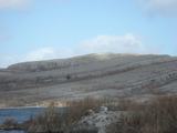 Burren National ParkNature reserve · 2.3 mi
Explorer Tom The Burren National Park is Ireland's smallest national park, and it still gives you 1,500 hectares in which to lose an…
 Michael Cusacks GAA pitchGAA ground · 2.4 mi
 The Portal TombVisitor information · 4.0 mi
Explorer Tom The Monastery of St. Senan is absolutely sick of being asked if it’s haunted, as if every old stone building in Clare…
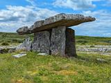 Poulnabrone DolmenHeritage attraction · 4.0 mi
Explorer Tom You see a tidy little stone sculpture? Those builders had a much heavier job. Poulnabrone Dolmen stands in the Burren…
 Poulnabrone - Burren GeositeVisitor information · 4.0 mi
Explorer Tom Poulnabrone Burren Geosite in County Clare has a prophecy that the stones will dance at midnight, but they’ve been…
 Cave of the Wild HorsesCave · 4.9 mi
Explorer Tom Cave of the Wild Horses near Carran has an imaginary twin across the sea that never stops complaining about the…
More archaeology and monuments in County Clare · All of County Clare

What do you know about this place?Tap to add a comment or ask a question