
What is recorded here
Situated within the valley of the Tolka River, with a meandering NNW-SSE section of the stream c. 150m to the SW, and a relict pond just to the W. Archaeological centre-line testing (04E0490) by R. O’Hara of Testing area 6 of Contract 1 of the M3 motorway identified a spread of deposits (excavations.ie: 2004:1232)…
Read the whole record
From the National Monuments Service (Archaeological Survey of Ireland) record ME050-056
Places near here
Photo credits
- National Inventory of Architectural Heritage
- Kmcnamee, Wikimedia Commons · CC BY-SA 4.0
- Maker not stated on source page, www.joinmychurch.com
- Maker not stated on source page, en.wikipedia.org
- Maker not stated on source page, www.europeanheritageawards.eu
- Chris Andrews, Geograph · CC BY-SA 2.0
- The British Library, Wikimedia Commons · No restrictions
- EecherplazGinkgo06.jpg : Cayambe derivative work: Ginkgotree ( talk ), Wikimedia Commons · CC BY-SA 3.0
- Mike Murphy ( talk · contribs ), Wikimedia Commons · CC BY-SA 3.0
 bridge755 yd
Explorer Tom This Bennetstown bridge was built after two lads bet in the pub that masons could make stone look tough. They won…
 St. Paul's GAA pitchGAA ground · 970 yd
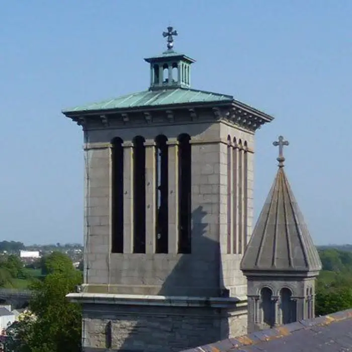 Church in DunboyneChurch · 1265 yd
Explorer Tom Church in Dunboyne is at the edge of town, where it was known as Kilbraynan, which sounds like a sneeze. If it posted…
 Enclosure in Piercetown (dunboyne By.)Enclosure · 1325 yd
Explorer Tom Enclosure in Piercetown is protected by a hero nobody remembers who saved it from being paved over for a car park. It…
 EnclosureEnclosure, large enclosure · 1391 yd
Explorer Tom Enclosure in Piercetown is basically a giant bet two lads made in the pub that they could fence off nothing and call it…
 Site of Piercetown CastleBarrow, mound barrow · 1410 yd
Explorer Tom Site of Piercetown Castle was taken over by a fox who now acts like it owns the place. The castle is gone, but the fox…
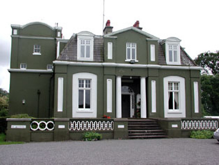 CourthillCountry house · 1.4 mi
Explorer Tom Courthill House is a mashup of 1830 and 1900 architecture, like wearing a top hat with sneakers. It’s got Doric columns…
CastleCastle, tower house · 1.5 miExplorer Tom Castle in Castlefarm has a long list of former names, mostly just variations of 'Big Stone Box'. William le Petit…
 Dunboyne CastleCountry house · 1.5 mi
Explorer Tom Dunboyne Castle would ace a job interview by simply standing there and looking expensive. It’s now part of a spa, which…
 Luttrellstown CastleCastle · 4.7 mi
Explorer Tom Luttrellstown Castle in County Dublin has been featured in an 1898 book about picturesque Dublin, which makes it sound…
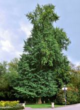 Ginkgo5.0 mi
Explorer Tom Ginkgo in County Dublin is an absolute fossil, older than your grandma’s dentures and twice as opinionated. It claims…
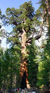 Giant Sequoia5.1 mi
Explorer Tom Giant Sequoia in County Dublin would win any county fair easily just by standing there and looking like it ate an…
More archaeology and monuments in County Meath · All of County Meath

What do you know about this place?Tap to add a comment or ask a question