What is recorded here
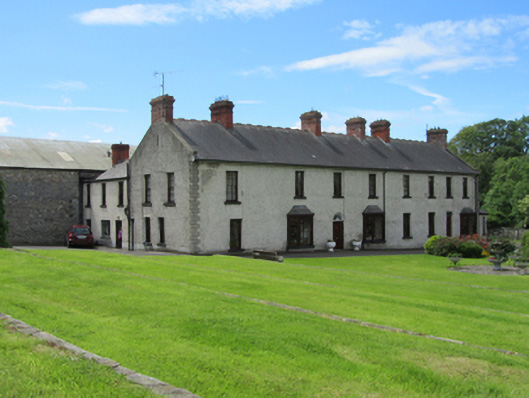
Detached eight-bay two-storey former distillery, built 1825, incorporating remains of an earlier structure and later nineteenth century extensions. Now in use as private house, with L-plan single-storey addition with entrance set in internal corner to west gable. Pitched slate roof with decorative clay ridge cresting, red brick chimneystacks with moulded courses to gables and unevenly spaces along ridge. Cast-iron rainwater goods. Roughcast rendered walls with smooth render quoins. Six-over-six replacement sliding sash windows with patent reveals and stone sills to front and sides. Recent timber bay windows with similar windows flanking main entrance door and in end bay to west. uPVC windows to rear. Round-headed front entrance with replacement panelled door and historic leaded spider's web fanlight. Square-headed door to western extension with reused eighteenth century eight-panelled door with margin panes to overlight. Retaining internal timber shutters to front elevation. Rubble stone outbuildings flank rear yard with brick dressing to square, arched and circular openings. Rubble stone wall marks boundary to adjacent yard with single-storey slated rubble stone outbuildings. Extensive front garden area with plain wrought-iron double-leaf gates flanked by similar pedestrian gates all in rendered piers.
Formerly a mill which gave the street its name, this large house was once located on the banks of the River Erne, from which it is now separated by a linear park. A stone inside the house inscribed with the date 1702 indicates the possible survival of earlier fabric. Lewis's Topographical Dictionary of 1837 recorded an extensive distillery belonging to Messrs. Dickson, Dunlop and Co, erected in 1825 and enlarged and improved in 1830, producing 90,000 to 100,000 gallons of whiskey and employing about 100 people. The distillery closed in 1885 and the complex of buildings shown on the Ordnance Survey map of 1836 is now much reduced and part of a farm. The group of buildings is an important part of the industrial heritage of Belturbet, the riverside location demonstrating the importance of the Erne in former times as a source of power and clean water. The house evolved to its present extent over a longer period and contains layers and historic features from several periods. Its prominent location and imposing length make a notable contribution to the historic setting.
From the Buildings of Ireland (National Inventory of Architectural Heritage) record 40307021
This does not grant access. Most recorded buildings are privately owned; view them only from public ground unless the owner allows entry.
Places near here
Photo credits
- National Inventory of Architectural Heritage
- Kenneth Allen, Geograph · CC BY-SA 2.0
Turbet IslandWood · 113 ydTurbet Island Castle Motte and BaileyArchaeological place · 130 ydSit of CastleCastle, motte and bailey · 135 yd The RectoryRectory/glebe/vicarage/curate's house · 151 ydBelturbet Church (Annagh)Mausoleum · 177 ydBastioned fort in Corporation LandsBastioned fort · 196 ydMill WalkVisitor information · 200 ydBomb Victims MemorialMemorial · 330 ydBelturbet Railway Station Visitor CentreHeritage attraction · 491 ydWelcome to Belturbet StationVisitor information · 502 ydBelturbet Heritage Railway Station MuseumMuseum · 512 ydPutiaghan Lower ForestForest · 1711 yd
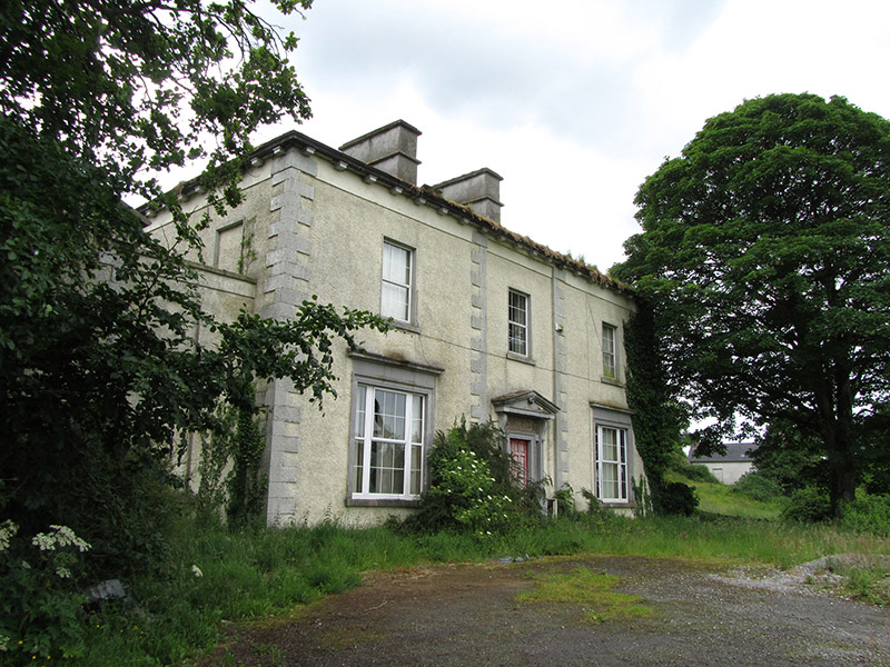 The RectoryRectory/glebe/vicarage/curate's house · 151 yd
 Belturbet Church (Annagh)Mausoleum · 177 ydBastioned fort in Corporation LandsBastioned fort · 196 yd
 Mill WalkVisitor information · 200 ydBomb Victims MemorialMemorial · 330 yd
 Belturbet Railway Station Visitor CentreHeritage attraction · 491 yd
 Welcome to Belturbet StationVisitor information · 502 yd
 Belturbet Heritage Railway Station MuseumMuseum · 512 yd
 Putiaghan Lower ForestForest · 1711 yd
More historic places in County Cavan · All of County Cavan
What do you know about this place?