
What is recorded here
From the Historic Environment Scotland record 172004
The historic-place record does not grant public access. Check current conditions and ownership before entering land or a building.
Places near here
 Blue Roofed HouseOld home or work place · 246 yd
 South Uist, Eriskay, Primary SchoolSchool · 360 yd
 South Uist, Eriskay, St Michael's Roman Catholic ChurchChurch (20th Century) · 391 yd
_-_geograph.org.uk_-_6491062.jpg/250px-View_to_Rubha_Ban_and_Sound_of_Eriskay_from_the_summit_of_Ben_Scrien_(1998)_-_geograph.org.uk_-_6491062.jpg "Photo: Colin Park, Wikimedia Commons · CC BY-SA 2.0") Ben ScrienKerb Cairn(s) (prehistoric) · 486 yd
Ben ScrienKerb Cairn(s) (prehistoric) · 486 yd Eriskay Cemetery at the edge of the seaChurch, cross or graveyard · 764 yd
 Rubha nan GobharHeadland · 884 yd
 Rubha ChlaidhHeadland · 897 yd
 Beinn SgritheannMountain / peak · 998 yd
 250th Anniversary of Charles Edward Stewart's Landing CairnMemorial · 1411 yd
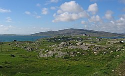 ÈirisgeighIsland · 1430 yd
 Coilleag a' PhrionnsaBeach / strand · 1446 yd
 Prince's Beach on EriskayBeach · 1548 yd
Pictures: Dave Fergusson, Wikimedia Commons · CC BY-SA 2.0; Gordon Hatton, Wikimedia Commons · CC BY-SA 2.0; Tom Richardson, Wikimedia Commons · CC BY-SA 2.0; Colin Park, Wikimedia Commons · CC BY-SA 2.0; Thomas Dick, Wikimedia Commons · CC BY-SA 2.0; Gordon Brown, Wikimedia Commons · CC BY-SA 2.0; Peter Moore, Wikimedia Commons · CC BY-SA 2.0; Mipmapped, Wikimedia Commons · CC BY-SA 3.0; Barbara Carr, Wikimedia Commons · CC BY-SA 2.0; Richard Webb, Wikimedia Commons · CC BY-SA 2.0; John Allan, Wikimedia Commons · CC BY-SA 2.0; Mike O'Shea, Wikimedia Commons · CC BY-SA 2.0
More historic places in Na h-Eileanan Siar · All of Na h-Eileanan Siar
What do you know about this place?