What is recorded here
In improved pasture, on a N-facing slope, c. 75m E of a townland boundary with Nicker. Not depicted on OSi historic maps. Visible as a potential site on aerial photographs (GSIAP R424). Monument surveyed by the ASI in 2008 and described as no surface remains visible, although there are slight linear undulations and low ridges across this area. Levelled monument is visible as a subrectangular-shaped cropmark (110m NW-SE; 95m NE-SW) on OSi orthoimage taken 2005-2012. Not visible on Google Earth orthoimage taken 18/11/2018. See attached Google Earth orthoimage 18/11/2018
Compiled by: Alison McQueen and Vera Rahilly
Date of upload: 26 September 2020
In improved pasture, on a N-facing slope, c. 75m E of a townland boundary with Nicker. Not depicted on OSi historic maps. Visible as a potential site on aerial photographs (GSIAP R424). Monument surveyed by the ASI in 2008 and described as no surface remains visible, although there are slight linear undulations and low ridges across this area. Levelled monument is visible as a subrectangular-shaped cropmark (110m…
From the National Monuments Service (Archaeological Survey of Ireland) record LI024-021
The monument record does not grant public access. Check the route and ask the landowner before entering private land.
- What survives
- Recorded monument
Places near here
 Station HouseRailway station · 199 yd
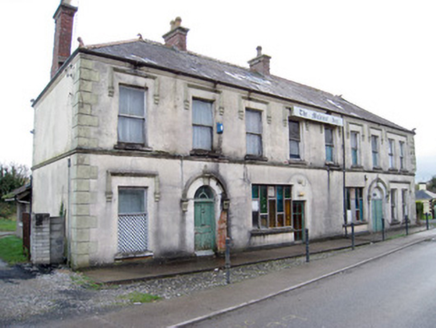 hotel246 yd
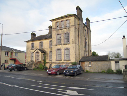 Pallas Grean Constabulary BarrackRic barracks · 270 yd
 E. O'DwyerHouse · 347 ydBarrowBarrow, ring-barrow · 392 yd
 Sunville HouseGate lodge · 947 yd
 Kilduff Castle (in ruins)Castle, tower house · 974 yd
 Kilduff CastleCastle · 976 yd
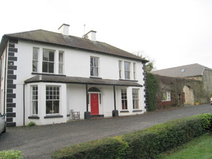 Mount CatherineHouse · 1013 ydToberagaddySpring · 1179 ydKnockseefinMountain / peak · 1.2 mi
 Standing stone in Longstone (cullen Par.)Standing stone · 4.5 mi
Pictures: National Inventory of Architectural Heritage; P L Chadwick, Geograph · CC BY-SA 2.0; Graham Horn, Geograph · CC BY-SA 2.0; Mike Searle, Wikimedia Commons · CC BY-SA 2.0; EamonnPKeane, Wikimedia Commons · CC0
More archaeology and monuments in County Limerick · All of County Limerick
What do you know about this place?