What is recorded here
In reclaimed pasture, 75m E of watercourse that forms townland boundary with Cloonyscrehane and 125m W of River Deel. Ringfort (LI036-080----) lies 280m to the SW. Not marked on OSi historic maps. Identified by Faith Bailey after examination of aerial photographs (Bing maps aerial photograph 07/08/2018) and described as a circular enclosure defined by a fosse and slight bank (dims. c. 61m N-S; 58m E-W). Levelled monument visible as circular-shaped cropmark (diam. c. 30m) intersected at SE by a linear cropmark running N-S on OSi orthophotograph taken between 2005-2012 and on Google Earth orthoimages. See attached Google Earth orthoimages.
In reclaimed pasture, 75m E of watercourse that forms townland boundary with Cloonyscrehane and 125m W of River Deel. Ringfort (LI036-080----) lies 280m to the SW. Not marked on OSi historic maps. Identified by Faith Bailey after examination of aerial photographs (Bing maps aerial photograph 07/08/2018) and described as a circular enclosure defined by a fosse and slight bank (dims. c. 61m N-S; 58m E-W). Levelled…
From the National Monuments Service (Archaeological Survey of Ireland) record LI036-215
The monument record does not grant public access. Check the route and ask the landowner before entering private land.
- What survives
- Recorded monument
Places near here
Photo credits
- National Inventory of Architectural Heritage
- Mike Searle, Wikimedia Commons · CC BY-SA 2.0
- Garry Dickinson, Geograph · CC BY-SA 2.0
- Created by Kglavin Modified Aug 2007 by Mike Christie, Wikimedia Commons · CC BY-SA 3.0
- A.-K. D., Wikimedia Commons · CC BY-SA 4.0
- Willow, Wikimedia Commons · CC BY 2.5
- Jonathan Thacker, Geograph · CC BY-SA 2.0
 bridge222 ydEnclosure in KillelineEnclosure · 1587 yd
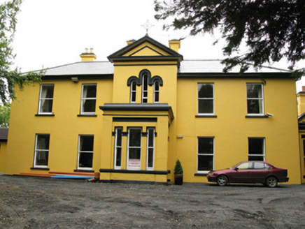 Beechwood HousePresbytery/parochial/curate's house · 1600 yd
,_Newcastle_West,_Limerick_-_geograph.org.uk_-_1392672.jpg/250px-Castles_of_Munster,_Desmond_Hall_(Castle_Banqueting_Hall),_Newcastle_West,_Limerick_-_geograph.org.uk_-_1392672.jpg "Photo: Mike Searle, Wikimedia Commons · CC BY-SA 2.0") Templars Castle (in ruins)Castle, Anglo-Norman masonry castle · 1.3 mi
Templars Castle (in ruins)Castle, Anglo-Norman masonry castle · 1.3 mi Castle MahonCastle · 1.6 mi
 Ardagh FortArchaeological place · 3.9 mi
 Saint Ite's WellSpring · 4.4 mi
 European ash4.5 miGarbally WellSpring · 4.6 miLimerick GreenwayWalking route · 4.6 miBallagh MountainMountain / peak · 5.6 mi
 Three CountiesPicnic place · 13 mi
More archaeology and monuments in County Limerick · All of County Limerick
What do you know about this place?