What is recorded here
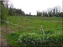
Situated on a SW-facing slope among the drumlins of Lough Oughter. A large subrectangular but curvilinear grass-covered area (dims c. 100m WNW-ESE; c. 90m NNE0-SSW) is visible on Digital Globe (2017) and on OSI images (2018). It appears to be defined by a broad earthen bank or scarp, but the perimeter is incorporated into a field bank W-NW and had been incorporated into a field bank S-W (1908 OS 6-inch map) that is now removed. It is also visible on Google Earth (24/03/2017; 07/02/2019) and the perimeter at E was incorporated in a field bank (1835 OS 6-inch map) that has also been removed. It was first reported by Liam Kenny. See the attached enhanced view from Google Earth
Compiled by: Michael Moore
Date of upload: 14 June 2019
Situated on a SW-facing slope among the drumlins of Lough Oughter. A large subrectangular but curvilinear grass-covered area (dims c. 100m WNW-ESE; c. 90m NNE0-SSW) is visible on Digital Globe (2017) and on OSI images (2018). It appears to be defined by a broad earthen bank or scarp, but the perimeter is incorporated into a field bank W-NW and had been incorporated into a field bank S-W (1908 OS 6-inch map) that…
From the National Monuments Service (Archaeological Survey of Ireland) record CV015-078
The monument record does not grant public access. Check the route and ask the landowner before entering private land.
- What survives
- Recorded monument
Places near here
ArdanMountain / peak · 345 yd Church in ruinsReligious house, Augustinian canons · 1612 ydDrumlane AbbeyHeritage attraction · 1628 ydSaint Patrick's Catholic ChurchChurch/chapel · 1648 ydPutiaghan Lower ForestForest · 1.8 miBelturbet Railway Station Visitor CentreHeritage attraction · 2.6 miWelcome to Belturbet StationVisitor information · 2.6 miMill WalkVisitor information · 2.8 miClogh Oughter CastleCastle, Anglo-Norman masonry castle · 2.9 miCourt tomb in GartnanoulCourt tomb · 3.8 miEuropean Beech4.5 miCastle SaundersonCastle, unclassified · 6.0 mi
 Church in ruinsReligious house, Augustinian canons · 1612 yd
 Drumlane AbbeyHeritage attraction · 1628 yd
 Saint Patrick's Catholic ChurchChurch/chapel · 1648 yd
 Putiaghan Lower ForestForest · 1.8 mi
 Belturbet Railway Station Visitor CentreHeritage attraction · 2.6 mi
 Welcome to Belturbet StationVisitor information · 2.6 mi
 Mill WalkVisitor information · 2.8 mi
 Clogh Oughter CastleCastle, Anglo-Norman masonry castle · 2.9 mi
 Court tomb in GartnanoulCourt tomb · 3.8 mi
 European Beech4.5 mi
 Castle SaundersonCastle, unclassified · 6.0 mi
Pictures: Oliver Dixon, Wikimedia Commons · CC BY-SA 2.0; Deadstar, Wikimedia Commons · CC BY-SA 4.0; Kenneth Allen, Geograph · CC BY-SA 2.0; Adam Simpson, Geograph · CC BY-SA 2.0; NTF30, Wikimedia Commons · CC BY-SA 4.0; Malene Thyssen, Wikimedia Commons · CC BY-SA 3.0; Mike Searle, Geograph · CC BY-SA 2.0
More archaeology and monuments in County Cavan · All of County Cavan
What do you know about this place?