What is recorded here
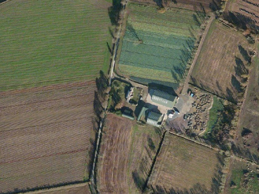
Situated on W-facing slope. The faint cropmark of a subcircular area (dims c. 45m N-S; c. 38m E-W) defined by a slight fosse is visible only on Google Earth (14/07/2018). There is a large excavated feature (dims c. 40m NE-SW; c. 12m NW-SE) on the line of a NW-SE relict field drain coinciding with the perimeter W-N, and another relict NE-SW field drain crosses the interior. It was first reported by Jean Charles Caillère.
See the attached enhanced aerial view from Google Earth
Compiled by: Michael Moore
Date of upload: 11 March 2020
The monument record does not grant public access. Check the route and ask the landowner before entering private land.
- What survives
- Recorded monument
Places near here
 Tincurry Cottagefarm house · 573 yd
 Enclosure in TincurryEnclosure · 952 yd
 IndicatedFairy fort / earthen ringfort · 983 yd
 Ballyduff Housefarm house · 1437 yd
 CastleCastle, unclassified · 1.6 mi
 European LarchEuropean Larch · 3.6 mi
 European YewEuropean Yew · 3.6 mi
 Bernard Dunne Memorial BenchMemorial · 4.9 mi
 U.N. Peace MemorialMonument · 4.9 mi
 Battle of Vinegar Hill, 1798Monument · 4.9 mi
 Vinegar HillMountain / peak · 5.0 mi
 Battle of Vinegar HillMajor battlefield · 5.0 mi