Places near here
Photo credits
- National Inventory of Architectural Heritage
- Algirdas at Lithuanian Wikipedia, Wikimedia Commons · Public domain
- Sciadopitys from UK, Wikimedia Commons · CC BY-SA 2.0
- Darrin Antrobus, Wikimedia Commons · CC BY-SA 2.0
- John M, Wikimedia Commons · CC BY-SA 2.0
- MikeWest Wexford, Wikimedia Commons · CC BY-SA 4.0
- Colin Park, Geograph · CC BY-SA 2.0
Explorer Tom Enclosure in Tincurry is a circular mark at the bottom of a slope where the weather has had a long, bitter grudge against it for years. Every storm seems to target this specific spot, as if the clouds are personally offended by its existence and want to flatten it back into the earth forever. Look serious, nod slowly, you're basically an expert now.
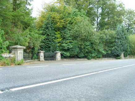 Farmley HouseGates/railings/walls · 718 yd
Explorer Tom Farmley House gates are showing off their Carew-Cliffe monogram like they’re at a fancy party where nobody else knows the dress code. They’re basically repurposed leftovers from an old estate, still flexing in the tree-lined street. I bet they hear the ghosts of old money arguing over who built what first. Take a peek from the sidewalk.
Enclosure in BallycarneyEnclosure · 1180 ydExplorer Tom Enclosure in Ballycarney claims to hold the world record for being the most politely ignored circle in all of Wexford. It’s just sitting there on the slope, judging your life choices with its forty-metre diameter of silence. Bring a pen pal, they'll be jealous.
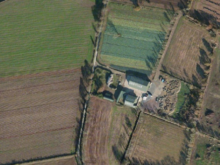 Tincurry CottageFarm house · 1483 yd
Explorer Tom Tincurry Cottage was built by Charles Lett, who probably thought he was doing something fancy back in the early 1800s. A local priest once bet he could sleep there for a week without hearing ghosts, but he lost and moved out. Rumble on if you hear any suspicious noises from that solid wall!
CastleCastle, unclassified · 2.1 miExplorer Tom Castle in Craan was built by a matchmaker who thought stone walls were better than gossip. She probably tried to pair off the local lords through the arrow slits. Get a photo with it before it gets a better agent.
 Pedunculate Oak3.4 mi
Explorer Tom Pedunculate Oak in County Wexford is showing off its acorns like it’s on a dating app. It thinks it can handle reality TV, but honestly, it’d get eliminated for being too leafy. Best seen with a hangover and a sausage roll.
 European Larch3.7 mi
Explorer Tom European Larch has a family tree that’s mostly made up, just like my excuse for being late. It drops its needles every winter because it’s too dramatic to keep them. Go on a wet day, it suits the mood.
 Battle of EnniscorthyBattle · 4.6 mi
Explorer Tom The Battle of Enniscorthy happened because someone lost an apple pie in the mud. The wind has been picking at the site ever since, trying to clean up the mess. It’s still got crumbs on it. Sit on a wall near it and pretend you're in a painting.
Battlefield in EnniscorthyBattlefield · 4.6 miExplorer Tom This Enniscorthy spot thinks it’s the only battlefield with actual style, which is a bold claim for a field of nothing. It’s proud of its silence and the way the wind sounds like a ghostly trumpet. Bring a map, get lost anyway, that's the fun.
 1798 MemorialStatue · 4.6 mi
Explorer Tom The 1798 Memorial in Wexford would explain the 1800s to a teenager by calling them 'mid' and complaining about the lack of Wi-Fi back then. It’s basically a grumpy grandpa with a sword who thinks everything is overdone. Bring a camera and your most suspicious face.
 Enniscorthy CastleMuseum · 4.6 mi
Explorer Tom Enniscorthy Castle has had so many owners that I would need a bigger key ring than the town has shops. Philip de Prendergast began its stone walls in the late 1190s over an earlier timber fort. Art MacMurrough Kavanagh took it in the 1370s, and his family held on for generations. Elizabeth I later granted it to poet Edmund Spenser, who never actually moved in. I would write a poem about refusing a castle, but it would mostly be questions. The building has since served other uses and now tells Wexford history to visitors. Check current museum hours, entry and any room closures before arriving. Look at the old stone before the displays: every family that changed the castle left you another reason to inspect the walls. Spenser missed that opportunity; you need not.
 IndicatedCastle, tower house · 4.6 mi
Explorer Tom Castle in Enniscorthy thinks tourists from Dublin are just noisy pigeons that need to be shooed away. It grew around a manor that’s older than most of our current fads are. Grand place for a sulk or a snog, your call really.
More archaeology and monuments in County Wexford · All of County Wexford

What do you know about this place?Tap to add a comment or ask a question