
What is recorded here
From the National Monuments Service (Archaeological Survey of Ireland) record OF037-010
Places near here
Photo credits
- Maker not stated on source page, www.dreamstime.com
- Maker not stated on source page, ch.pinterest.com
- Maker not stated on source page, wanderyourway.com
- Jonathan Thacker, Geograph · Creative Commons Attribution-ShareAlike 2.0
- Maker not stated on source page, ru.pinterest.com
- Maker not stated on source page, commons.wikimedia.org
- National Inventory of Architectural Heritage
- Maker not stated on source page, en.wikipedia.org
- Maker not stated on source page, www.alamy.com
 Inauguration stone in CoolcreenInauguration stone · 1131 yd
Explorer Tom Inauguration stone in Coolcreen thinks seagulls are just vultures with better PR teams. It was moved to Cadamstown in…
 Cist in Magherabane (ballybrit By.),spinkCist · 1265 yd
Explorer Tom Cist in Magherabane, Spink is an unlocated burial mound with a possible cist inside, so it’s a mystery box of dirt and…
 Church (in Ruins)Church · 1480 yd
Explorer Tom Church in Letter in County Offaly had a fox take charge of the place during a particularly boring Tuesday afternoon.…
 ToberlugnaHoly well · 1537 yd
Explorer Tom Toberlugna in Letter is half a wall and full of mystery. It stands next to a church, pretending it’s not tired of being…
 CastleCastle, unclassified · 1560 yd
Explorer Tom Castle in Ballykelly is complaining to the council that it’s been misfiled for centuries. It thinks it belongs next…
 Enclosure in PigeonstownEnclosure · 1.4 mi
Explorer Tom Enclosure in Pigeonstown is feuding with the next village over who stole their quarrying equipment. The bank is gone…
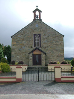 Saint Luna's Catholic ChurchChurch/chapel · 1.4 mi
Explorer Tom Saint Luna's Catholic Church in Cadamstown has carved stones that look like they’ve seen some serious stuff over a…
Inauguration stone (present location) in CadamstownInauguration stone (present location) · 1.4 miExplorer Tom Inauguration stone in Cadamstown is a big boulder that kings probably stood on to get their crowns. The seagulls around…
 Stone head in CadamstownStone head · 1.4 mi
Explorer Tom Stone head in Cadamstown was used as a corbel, so it spent centuries holding up a church wall while judging everyone…
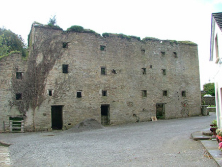 mill (water)1.4 mi
Explorer Tom Mill in Cadamstown is where the Vikings got lost looking for a bathroom, according to local rumour. It milled flour and…
 Drumcullen GraveyardGraveyard · 3.7 mi
Explorer Tom Drumcullen Graveyard in County Offaly would handle a nosey neighbour by simply shifting its shadow to block their view.…
 Mapped cemeteryCemetery · 5.3 mi
Explorer Tom Mapped cemetery in County Offaly is the sort of spot a local might claim he invented back in the day, probably over a…
More archaeology and monuments in County Offaly · All of County Offaly

What do you know about this place?Tap to add a comment or ask a question