What is recorded here
On gentle S-facing slope with stream running E-W c. 30m to S, in pastureland. Enclosure not marked on 1st (1840) ed. OS 6-inch map. Small roughly square area (diam. 13.6m N-S; 15.5m E-W) enclosed by low, flattened earth and stone bank (Wth 1.7m crest, 2.2m base; int. H 0.23m; ext. H 0.63m) with rounded corners. No visible external fosse. There is a lot of stone strewn around the interior, monument used for field clearance debris. Small trees are growing on the bank and in interior in the SE quadrant.
On gentle S-facing slope with stream running E-W c. 30m to S, in pastureland. Enclosure not marked on 1st (1840) ed. OS 6-inch map. Small roughly square area (diam. 13.6m N-S; 15.5m E-W) enclosed by low, flattened earth and stone bank (Wth 1.7m crest, 2.2m base; int. H 0.23m; ext. H 0.63m) with rounded corners. No visible external fosse. There is a lot of stone strewn around the interior, monument used for field…
From the National Monuments Service (Archaeological Survey of Ireland) record TS086-008
The monument record does not grant public access. Check the route and ask the landowner before entering private land.
- What survives
- Recorded monument
Places near here
Photo credits
- Martin Richard Phelan, Wikimedia Commons · CC BY-SA 2.0
- National Inventory of Architectural Heritage
- Ivar Leidus, Wikimedia Commons · CC BY-SA 3.0 ee
- Mike Murphy ( talk · contribs ), Wikimedia Commons · CC BY-SA 3.0
- Mike Searle, Wikimedia Commons · CC BY-SA 2.0
- A copy of this photograph is owned by National Library of Ireland and can be viewed here [1], Wikimedia Commons · Public domain
- john salter, Geograph · CC BY-SA 2.0
- Colin Park, Geograph · CC BY-SA 2.0
Enclosure in DanganEnclosure · 1579 yd Mitchelstown CaveCave · 1730 ydCoolantallagh HouseHouse · 1.1 miSkeheenaranky National SchoolSchool · 1.3 miEcclesiastical enclosure in SkeheenarankyEcclesiastical enclosure · 1.3 miRonald Reagan CentreHeritage attraction · 2.0 miNorway Spruce2.2 miGiant Sequoia2.3 miBurncourt CastleCastle · 2.7 miShanbally CastleCastle · 3.4 miCarran HillMountain / peak · 4.7 miMonabrackMountain / peak · 5.0 mi
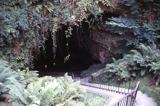 Mitchelstown CaveCave · 1730 yd
 Coolantallagh HouseHouse · 1.1 mi
 Skeheenaranky National SchoolSchool · 1.3 miEcclesiastical enclosure in SkeheenarankyEcclesiastical enclosure · 1.3 miRonald Reagan CentreHeritage attraction · 2.0 mi
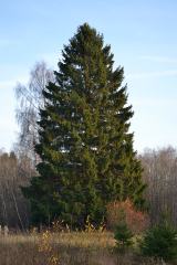 Norway Spruce2.2 mi
 Giant Sequoia2.3 mi
 Burncourt CastleCastle · 2.7 mi
 Shanbally CastleCastle · 3.4 mi
 Carran HillMountain / peak · 4.7 mi
 MonabrackMountain / peak · 5.0 mi
More archaeology and monuments in County Tipperary · All of County Tipperary
What do you know about this place?