What is recorded here
In improved pasture on a gentle SE-facing slope. No visible surface trace. Depicted on 1840 edition OS 6-inch map as an oval area (dims. c. 15m E-W; c. 10m N-S). This feature is depicted as a pond on the 1952/1954 OS 6-inch revision and survives as a pond. As there are a number of associated designed landscape features, particularly tree-rings, within Silverfort demesne this could be a landscape feature. However, it is also possile that this is an earlier enclosure which was excavated post 1840 to create a pond.
In improved pasture on a gentle SE-facing slope. No visible surface trace. Depicted on 1840 edition OS 6-inch map as an oval area (dims. c. 15m E-W; c. 10m N-S). This feature is depicted as a pond on the 1952/1954 OS 6-inch revision and survives as a pond. As there are a number of associated designed landscape features, particularly tree-rings, within Silverfort demesne this could be a landscape feature. However,…
From the National Monuments Service (Archaeological Survey of Ireland) record TS061-066
The monument record does not grant public access. Check the route and ask the landowner before entering private land.
- What survives
- Recorded monument
Places near here
Photo credits
- National Inventory of Architectural Heritage
- A.-K. D., Wikimedia Commons · CC BY-SA 4.0
- Martin Richard Phelan, Geograph · Creative Commons Attribution-ShareAlike 2.0
- Sitomon, Wikimedia Commons · CC BY-SA 2.0
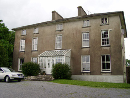 Silverfort HouseCountry house · 148 yd
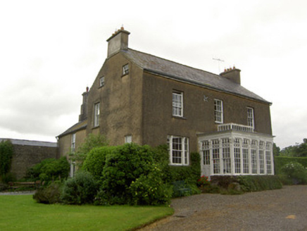 Beechmount HouseHouse · 464 yd
 CastleCastle, ringwork · 1238 ydTaylor's WoodWood · 2.0 miBallinure HillMountain / peak · 2.4 mi
.png/250px-Graystown_Castle_(1).png "Photo: A.-K. D., Wikimedia Commons · CC BY-SA 4.0") Castle (in ruins)Castle, tower house · 3.1 miKilknockan HillMountain / peak · 4.4 miGobban Saer's GraveArchaeological place · 4.9 mi
Castle (in ruins)Castle, tower house · 3.1 miKilknockan HillMountain / peak · 4.4 miGobban Saer's GraveArchaeological place · 4.9 mi Grave YardGraveyard · 5.1 mi
 European Yew5.1 miEast GateMemorial · 5.1 mi
 Sheela-na-gig in FethardSheela-na-gig · 5.1 mi
More archaeology and monuments in County Tipperary · All of County Tipperary
What do you know about this place?