DDiscover AloneMapAbout

Enclosure in Sheskin

Enclosure

The monument record does not grant public access. Check the route and ask the landowner before entering private land.

What do you know about this place?Tap to add a comment or ask a question

What you write will be public.

What is recorded here

This is a roughly square area with rounded corners (int. dims. 13m N-S and E-W), defined by a broad earthen bank (Wth at crest 1.5m; overall Wth 1.7-3m; int. H 0.45, 1m; ext. H 0.37-0.45m) with inner and outer stone revetment, though in some area this has been reduced to form a low, broad bank and the revetment is…

Read the whole record
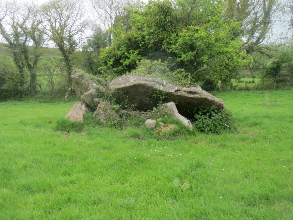
This is a roughly square area with rounded corners (int. dims. 13m N-S and E-W), defined by a broad earthen bank (Wth at crest 1.5m; overall Wth 1.7-3m; int. H 0.45—1m; ext. H 0.37-0.45m) with inner and outer stone revetment, though in some area this has been reduced to form a low, broad bank and the revetment is reduced to an inner and outer kerbing. The interior is sunken, however, while the ground surrounding the enclosure is very wet and muddy, the interior is dry. Within the interior there are two bedrock outcrops and in the S sector there is a large split boulder. The interior is quite overgrown with gorse and scrub. There is a stone-lined entrance in the SE sector (Wth 1.3m; L 3m) and to the S of the entrance, at the SE angle of the enclosure, there is a small rectangular stone feature, possibly the base of a gate pier. At a distance of 7.2m to the SW there is a small stone structure (H c. 1m; L c. 2m) of rough walling which is described by the present landowner as the remains of a windmill. This may have been related to the meteorological activities of Joseph Grubb who, in 1899, built the nearby Sheskin House, 150m to the SE, and who had a keen interest in geology, botany and archaeology (Ahern 2009, 284-5). The enclosure seems be that which is described and published in 1944 by Joseph’s daughter Isabel Grubb, as a ‘prehistoric burial site’. It is described by Ms. Grubb (1944, 176) as measuring, ‘roughly thirty-five feet [10.67m] from north to south and twenty-five [7.62m] from east to west. The main “chamber” consists of a box-like structure formed of slabs mostly tilted out of place, and one has fallen into the central hole making the entrance to the space under it too small to permit of examination. These stones measure on average 4ft. [1.2m] by 2½ft. [0.76m] by 2ft. [0.6m], which may have been the capstone. Immediately south of the “chamber” is a piece of apparently unmoved bed rock about 7ft. [2.1m] by 4ft. [1.2m]. At a distance of several feet from the central group upright stones form an oval round the whole, with a second line of stones less regular within the outer line. These stones average about 3ft. [0.9m0] by 2½ft. [0.76m] by 2ft. [0.6m], the inner ones being smaller. Some are tilted and some appear to have been smashed. All are much weathered’. The date and function of this enclosure are unknown. Though the enclosure may be modern, it seems probable that it pre-dates Sheskin House and any accompanying landscaping of the grounds, as it seems likely that Ms. Grubb would have been familiar with any landscape features created by her father. The 1st ed. (1841) 6-inch OS map shows bog/marsh land in this area before Sheskin House was built.

From the National Monuments Service (Archaeological Survey of Ireland) record WA003-088001

Places near here

Photo credits
  • Maker not stated on source page, www.dreamstime.com
  • Maker not stated on source page, www.pinterest.com
  • Maker not stated on source page, scotlanditineraryplanning.com
  • Maker not stated on source page, paganplaces.com
  • Kmcnamee, Wikimedia Commons · CC BY-SA 4.0
  • Maker not stated on source page, www.geograph.ie
  • National Inventory of Architectural Heritage
  • Andreas F. Borchert, Wikimedia Commons · CC BY-SA 4.0
  • A.-K. D., Wikimedia Commons · CC BY-SA 4.0
  • Maker not stated on source page, nycemetery.wordpress.com
Standing stoneStanding stone, pair · 576 yd

Explorer Tom Standing stone in Sheskin is actually a pair of stones standing close together like gossiping aunties. They’re aligned…

Megalithic tomb in Sheskin (upperthird By.)Megalithic tomb · 673 yd

Explorer Tom Megalithic tomb in Sheskin is basically a rumor that got promoted to monument status because nobody checked the field…

Standing stone in Sheskin (upperthird By.)Standing stone · 673 yd

Explorer Tom Standing stone in Sheskin is supposedly seven feet high but nobody can find it anymore. Rumor says there’s a tunnel to…
Portal tomb in Sheskin (upperthird By.)Portal tomb · 1100 yd

Explorer Tom Portal tomb in Sheskin is playing hard to get, its roof stone has slipped off like it’s ditching its best mate at a…

St. Mollerans GAA pitchGAA ground · 1180 ydChurch in JoanstownChurch · 1512 yd

Explorer Tom Church in Joanstown is known as Mary's church, but it disappeared so completely that even the locals can't point you to…

Coolnamuck CourtFolly · 1628 yd

Explorer Tom Coolnamuck Court is a derelict folly where the builder was probably thinking about a very large salad while laying the…

Saint Francis's Catholic ChurchChurch/chapel · 1.0 mi

Explorer Tom Saint Francis's Catholic Church in Carrickbeg started because two lads made a bet in the pub about who could build it…

CastleCastle, unclassified · 1.1 mi

Explorer Tom Castle in Carrickbeg is where the local sheep hold council meetings to decide which tourists are too loud for their…

Saint Molleran's Catholic ChurchChurch/chapel · 1.1 mi

Explorer Tom Saint Molleran's Church has a medieval gable that makes the Protestant rector feel very small and very wrong. It…

St. Mary's CemeteryCemetery · 1.1 mi

Explorer Tom St. Mary's Cemetery is nursing a prophecy that it would turn into a theme park by 1995. It never happened, mostly…

Páirc Daibhín, Carrick DavinsGAA ground · 1.2 mi

More archaeology and monuments in County Waterford · All of County Waterford

Add to this placeAdd a picture Add a detailed tip Add a story

Explore the map1,095,414 places to discover

Next place · or swipeStanding stone