
What is recorded here
On generally flat summit of hill in undulating terrain, under fairly lush pasture. Land rises very gradually to S and W. A large enclosure (TS076-001003-) is conjoined to the E of this monument and field banks (TS076-001002-) are associated with it. Bivallate ringfort (TS076-003----) located c. 150m to NE. Enclosure is levelled, however, its outline is clearly visible as a cropmark, with lush grass and thistles growing in former fosse (Wth 3-4m). A square enclosure (diam. c. 28m N-S; 28.7m E-W), the outline of which is clearly visible on the ground as a cropmark, with lush grass and thistles growing in the former fosse (Wth 3-4m). In 1982 (Cahill) the enclosure was delimited by a low bank and fosse. In an earlier aerial photograph (CUCAP 13 July 1966 AOZ 96) the enclosure is obscured by trees. More recent aerial photographs, ASIAP (31) 8-10 (1996?) show the outline of the monument as a cropmark.
Compiled by: Jean Farrelly
Date of upload: 26 August 2011
The monument record does not grant public access. Check the route and ask the landowner before entering private land.
- What survives
- Recorded monument
Places near here
 IndicatedEnclosure · 381 yd
 Outeragh Castle (in ruins)Castle, unclassified · 879 yd
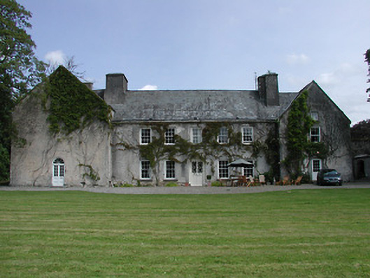 Enclosure in KnockgraffonEnclosure · 1032 yd
 Outeragh Church (in ruins)Church · 1070 yd
 Outrath Lodgerectory/glebe/vicarage/curate's house · 1188 yd
 Bawn in KedrahBawn · 1.4 mi
 Caher AbbeyHeritage attraction · 3.4 mi
 Siege of Cahir Castlesiege · 3.6 miCahir CastleHeritage attraction · 3.7 mi
 Caucasian zelkovaCaucasian zelkova · 4.3 mi
 Pedunculate OakPedunculate Oak · 4.5 mi
 Slieveanard NE TopMountain / peak · 4.9 mi
Other information
Photo: Credit not shown in the picture search · Rights wording not checked; contact us if this picture should be removed