
What is recorded here
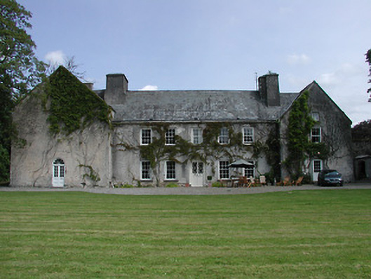
On a slight rise in gently undulating terrain, surrounded by pasture, with the main N8 Cahir-Cashel road running N-S to the W. Geoffrey Keating (Seathrún Céitinn) was the parish priest of Outeragh in 1610 (Killanin and Duignan 1967, 133). The church (ext. dims. 8.8m N-S; 19.9m E-W; wall T 0.95-1.05m) is roughly centrally placed within a rectangular graveyard (TS076-018001-) and built of roughly coursed limestone rubble with occasional sandstone conglomerate. The E and W gables of the church are heavily ivy covered, though the outline of a bellcote is visible on the latter. Only the E end of the N wall survives (H 3.6m) and evidence of a doorway in the W end is indicated by a drawbar-hole in the masonry. A short length of the W end of the S wall survives. According to the OS Letters of 1840 there was a 'clump of the south wall attached at some height from the ground to the east gable, on which some traces of the eastern side of a window are noticeable' (O'Flanagan 1930, vol. 2, 122). A large broken-out window in the E gable is splayed internally, the surrounds are missing, though according to Cahill (unpublished 1982) it had sandstone dressing and a sandstone jambstone with an external chamfer lies at the internal base of the E gable. Along the N wall there is a tall narrow embrasure, the window itself broken out. The N wall has a slight base-batter (Wth 0.3m; H 1.25m), but this has been removed at the E end and the wall straightened and repointed to provide a back wall for a modern 'oratory' or prayer shelter. Otherwise this structure consists of a concrete plinth and slated gabled roof held up by sections of pipe filled with concrete. The N end of the W wall has been altered. While the lower courses remain, the wall above has been re-faced and, in effect, shortened.
Compiled by: Jean Farrelly
Date of upload: 26 August 2011
Outeragh Church was built in the early medieval period, likely before the 12th century, and is dedicated to St. Fachtna. It is a small, ruined church associated with the early Christian tradition in Munster, and its location reflects the pattern of early monastic settlements in the region.
This remains an important historical record, but the official description says the monument is no longer visible or has been destroyed. The monument record does not grant public access. Check the route and ask the landowner before entering private land.
- What survives
- No visible remains or recorded as destroyed
Places near here
 Outrath Lodgerectory/glebe/vicarage/curate's house · 138 yd
 Outeragh Castle (in ruins)Castle, unclassified · 213 yd
 Enclosure in KnockgraffonEnclosure · 706 yd
 IndicatedEnclosure · 975 yd
 Bawn in KedrahBawn · 1540 yd
 Mortlestown Church (in ruins)Church · 1.0 mi
 Caher AbbeyHeritage attraction · 2.9 mi
 Siege of Cahir Castlesiege · 3.1 miCahir CastleHeritage attraction · 3.2 mi
 European YewEuropean Yew · 4.2 mi
 Caucasian zelkovaCaucasian zelkova · 4.3 mi
 Slieveanard NE TopMountain / peak · 4.7 mi
Other information
Photo: Credit not shown in the picture search · Rights wording not checked; contact us if this picture should be removed