What is recorded here
On an E-facing slope of a NE-SW ridge in undulating countryside with good views in all directions. Identified as an enclosure from aerial photographs (GSI S. 590/589 16-04-74). A low, poorly preserved, much degraded enclosure consisting of a circular area (diam. 55m NW-SE; 37m E-W) defined by a scarp (H 0.65m), fosse (Wth 4m; ext. D 0.1m) and possible external bank (Wth 5m; ext. H 0.15m) visible on the W side only. There is no clearly defined enclosing element on the E side where a natural fall of ridge appears to form the E edge of the enclosure. A surviving field boundary intersects with the possible external bank at the S quadrant on an E-W axis.
On an E-facing slope of a NE-SW ridge in undulating countryside with good views in all directions. Identified as an enclosure from aerial photographs (GSI S. 590/589 16-04-74). A low, poorly preserved, much degraded enclosure consisting of a circular area (diam. 55m NW-SE; 37m E-W) defined by a scarp (H 0.65m), fosse (Wth 4m; ext. D 0.1m) and possible external bank (Wth 5m; ext. H 0.15m) visible on the W side…
From the National Monuments Service (Archaeological Survey of Ireland) record TS046-029
The monument record does not grant public access. Check the route and ask the landowner before entering private land.
- What survives
- Recorded monument
Places near here
Photo credits
- National Inventory of Architectural Heritage
- Garry Dickinson, Geograph · CC BY-SA 2.0
- Mike Searle, Wikimedia Commons · CC BY-SA 2.0
- Steven Brown, Geograph · Creative Commons Attribution-ShareAlike 2.0
- Ronnie Nijboer, Wikimedia Commons · CC0
- Wanfried-Dublin, Wikimedia Commons · CC BY-SA 4.0
- Dublin Castle RIC, Wikimedia Commons · Public domain
- Willow, Wikimedia Commons · CC BY 2.5
- P L Chadwick, Geograph · CC BY-SA 2.0
- Colin Park, Geograph · CC BY-SA 2.0
- JP, Geograph · CC BY-SA 2.0
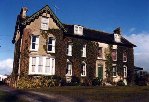 Marlow HouseHouse · 714 yd
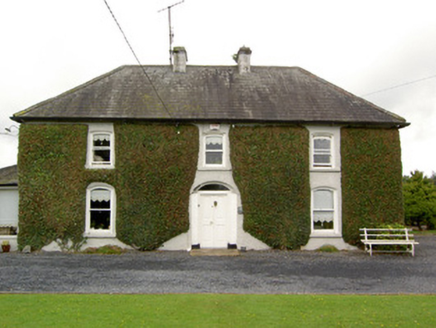 Clogher HouseHouse · 1.1 mi
 Castle FogartyCastle · 4.5 mi
 Ardmayle CastleCastle · 4.5 mi
 Grave YardGraveyard · 4.7 mi
 Wych Elm5.2 mi
.jpg/250px-KnockcurraghbolanCommons-TN39-009_(4).jpg "Photo: Wanfried-Dublin, Wikimedia Commons · CC BY-SA 4.0") Wedge tomb in Knockcurraghbola CommonsWedge tomb · 6.9 mi
Wedge tomb in Knockcurraghbola CommonsWedge tomb · 6.9 mi Soloheadbeg AmbushAmbush · 11 mi
 European ash11 mi
 Brian Boru Heritage CentreVisitor information · 24 mi
 SlievereaghMountain / peak · 25 mi
 Crow IslandIslet · 26 mi
More archaeology and monuments in County Tipperary · All of County Tipperary
What do you know about this place?