What is recorded here
Situated on a level landscape. The cropmark of a circular area (diam. c. 37m) defined by a slight fosse is visible on iMAPs (2019, 2022). It is truncated slightly by a WNW-ESE field bank at N. The enclosure is also visible on Google Earth (18/09/2019), and it was first reported by Jean Charles Caillére. See the attached enhanced views from _02 (Google Earth 18/09/2019), _03 iMAPs (2022)
Compiled by: Michael Moore
Date of upload: 6 June 2023
From the National Monuments Service (Archaeological Survey of Ireland) record WX054-018
The monument record does not grant public access. Check the route and ask the landowner before entering private land.
- What survives
- Recorded monument
Places near here
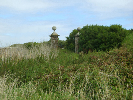 Loftus HallGates/railings/walls · 547 ydDuffins WellHoly well · 573 yd
 kiln611 yd
 Slade CastleHouse, fortified house · 655 yd
 Slade CastleCastle, tower house · 656 yd
 St. Dubhan's ChurchHeritage attraction · 838 ydThe Hall BayBeach / strand · 1205 yd
 hookHeritage attraction · 1328 ydDoornogeHeadland · 1585 ydLong RockNamed rock · 1602 yd
 Windmill (in Ruins)Windmill · 1.9 mi
 Sandeel BayBeach / strand · 2.2 mi
Pictures: National Inventory of Architectural Heritage; Ianfhunter, Wikimedia Commons · CC BY-SA 4.0; Michael Dibb, Geograph · CC BY-SA 2.0; Andreas F. Borchert, Wikimedia Commons · CC BY-SA 4.0; Alex Passmore, Geograph · CC BY-SA 2.0; Mike Searle, Geograph · CC BY-SA 2.0; Tim Kirby, Geograph · CC BY-SA 2.0
More archaeology and monuments in County Wexford · All of County Wexford
What do you know about this place?