What is recorded here
Marked on the 1841-42 OS map as a circular enclosure, this site does not appear on the later edition of 1915-16. No surface trace survives today. Toal, ‘North Kerry Archaeological Survey’. Dingle. Brandon in association with FAS Training and Employment Authority (1995), no. 1045.
From the National Monuments Service (Archaeological Survey of Ireland) record KE009-019
The monument record does not grant public access. Check the route and ask the landowner before entering private land.
- What survives
- Recorded monument
Places near here
Photo credits
- National Inventory of Architectural Heritage
- Colin Park, Wikimedia Commons · CC BY-SA 2.0
- Zairon, Wikimedia Commons · CC BY 4.0
- Grainne Toomey, Wikimedia Commons · CC BY-SA 4.0
- Patrice78500, Wikimedia Commons · Public domain
- Matthew Hatton, Geograph · CC BY-SA 2.0
- dennis white, Wikimedia Commons · CC BY-SA 3.0
RathroeArchaeological place · 778 ydCrazy GolfHeritage attraction · 1.6 mi Lisselton ChurchChurch/chapel · 2.0 miSaint Teresa's Catholic ChurchChurch/chapel · 2.4 miBawn in BallydonohoeBawn · 2.6 miKnockanoreMountain / peak · 2.8 miBallybunion Cliff PathWalking route · 3.1 miLadies' BeachBeach / strand · 3.1 miRound Tower3.1 miNuns' BeachBeach / strand · 3.4 miDoon PointHeadland · 4.1 miBromore CliffsCliff · 4.2 mi
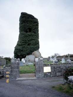 Lisselton ChurchChurch/chapel · 2.0 mi
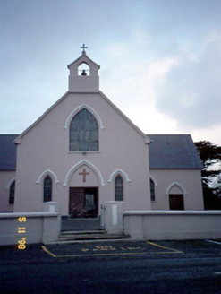 Saint Teresa's Catholic ChurchChurch/chapel · 2.4 miBawn in BallydonohoeBawn · 2.6 mi
 KnockanoreMountain / peak · 2.8 mi
 Ballybunion Cliff PathWalking route · 3.1 mi
 Ladies' BeachBeach / strand · 3.1 mi
 Round Tower3.1 mi
 Nuns' BeachBeach / strand · 3.4 mi
 Doon PointHeadland · 4.1 mi
 Bromore CliffsCliff · 4.2 mi
More archaeology and monuments in County Kerry · All of County Kerry
What do you know about this place?