
What is recorded here
In grassland, situated on low rise of ground on a S-facing slope in upland area with good views in all directions. Modern bungalow and boundary hedge immediately to NE of outer fosse. Barely visible outline of levelled enclosure (approx. diam. 57m N-S; 65m NE-SW) defined by a low rise of ground and remains of outer fosse (base Wth 2-6m; top Wth 4-10m; ext. D 1.3m; int. D 1.4m) at NE quadrant only, this feature appears to have been widened or interfered with probably when the enclosure was levelled. At NE the well preserved section of the fosse was wet at time of visit and is all that survive of the enclosing fosse. Depicted as a large irregular shaped enclosure with farm buildings adjoining SW perimeter of enclosure on first ed. OS 6-inch map. No traces of farm buildings, enclosure was probably levelled between 1840 and 1903. This feature may have had some relationship with the buildings which adjoined the SW angle of the enclosure.
Compiled by: Jean Farrelly
Date of upload: 26 August 2011
The monument record does not grant public access. Check the route and ask the landowner before entering private land.
- What survives
- Recorded monument
Places near here
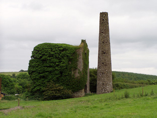 Mardyke Collieryengine house · 1064 yd
 Enclosure in BroomhillEnclosure · 1169 yd
 Enclosure in Ballincurry (crohane Par.)Enclosure · 1199 yd
 Mine in Ballinunty (graystown Par.),tullequaneMine · 1409 yd
 Waterloo HillMountain / peak · 1.0 mi
 CastleCastle, ringwork · 1.2 mi
 Coolquill CastleCastle · 1.3 mi
 Slieveardagh Heritage CentreVisitor information · 2.2 mi
 Eagle HillMountain / peak · 3.1 mi
 Derrynaflan TrailHeritage attraction · 3.3 mi
 Gobban Saer's GraveArchaeological place · 4.3 mi
 Horse and JockeyVisitor information · 5.5 mi
Other information
Photo: Credit not shown in the picture search · Rights wording not checked; contact us if this picture should be removed