
What is recorded here
On an undulating gravel ridge that falls away steeply to the NW, commanding the low ground of the river valley to the NW. A large mound (diam. 21-23m; H c. 3m) with a terrace (Wth 5-8m) all round and an uneven hollow in the centre. Possibly a scarped natural mound. Slight traces of a possible fosse and outer bank at SE. Traces of ridge and furrow remain right across the monument.
Compiled by: Mary Tunney
Date of upload: 12 November 2012
The monument record does not grant public access. Check the route and ask the landowner before entering private land.
- What survives
- Recorded monument
Places near here
 Enclosure in BallynureEnclosure · 749 yd
 Church in ColbinstownChurch · 871 yd
 Colbinstown Castle (in Ruins)Castle, unclassified · 902 yd
 Enclosure in KnockdooEnclosure · 1142 yd
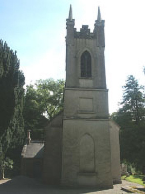 Church of the Ascension (Ballynure)church/chapel · 1237 yd
 Grangecon Castle (in ruins)Castle, tower house · 1.1 mi
 Spratstown Fox CovertWood · 1.3 mi
 Site of Fair GreenForest · 1.5 mi
 Memorial to 1798 rebellionMonument · 3.1 mi
 Ballyhook HillMountain / peak · 3.3 mi
 Tinoran HillMountain / peak · 4.5 mi
 Battle of Kilrushbattle · 5.3 mi
Other information
Photo: Credit not shown in the picture search · Rights wording not checked; contact us if this picture should be removed