
What is recorded here
From the National Monuments Service (Archaeological Survey of Ireland) record KE024-010
Places near here
Photo credits
- National Inventory of Architectural Heritage
- Maker not stated on source page, tr.pinterest.com
- Brosna GAA club promotional photograph via Smart Lotto; individual maker not named, smartlotto.ie
- Maker not stated on source page, www.flickr.com
- Maker not stated on source page, www.gettyimages.ca
- Maker not stated on source page, www.pinterest.com
- Maker not stated on source page, uk.pinterest.com
- Maker not stated on source page, irisharchaeology.org
- Maker not stated on source page, se.pinterest.com
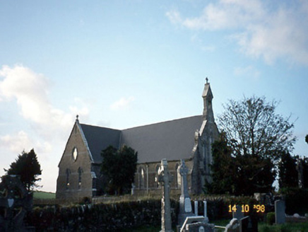 Saint Carthage's Catholic ChurchChurch/chapel · 1088 yd
Explorer Tom Saint Carthage's Catholic Church in Brosna East is jealous of its famous cousin across the county. It built itself…
 Bullaun stone in Brosna WestBullaun stone · 1192 yd
Explorer Tom Bullaun stone in Brosna West is sick of being asked if it’s broken. Two pieces sit there looking like they don’t quite…
 Brosna GAA pitchGAA ground · 1605 yd
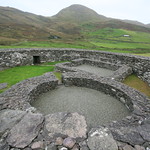 Enclosure in Reacaslagh (trughanacmy By.)Enclosure · 1.7 mi
Explorer Tom Enclosure in Reacaslagh was built on a bargain where someone traded a sheep for a circular dirt bank, and it’s still…
 Mapped cemeteryCemetery · 1.8 mi
Explorer Tom Mapped cemetery in County Limerick ended up in the wrong place because the surveyor took too long on his lunch break…
Enclosure in Brosna EastEnclosure · 1.9 miExplorer Tom Enclosure in Brosna East would survive a zombie attack by simply standing still and hoping they walk right through it.…
 Mountcollins BridgeBridge · 1.9 mi
Explorer Tom Mountcollins Bridge is friends with a famous engineer who never actually lived here but took all the credit. Its…
 Church in CloghvoulaChurch · 3.3 mi
Explorer Tom Church in Cloghvoula is playing hard to get, hiding behind stepping stones and zero visible trace. I reckon it took…
 Fairy fort / earthen ringfort in CurraghatoukFairy fort / earthen ringfort · 4.9 mi
Explorer Tom Fairy fort / earthen ringfort in Curraghatouk would tell its younger self to stop worrying about the kids' burial…
 Standing stone in TooreenclassaghStanding stone · 12 mi
Explorer Tom Standing stone in Tooreenclassagh used to be part of a trio until two got bored and left. Now it's just here, looking…
 Stone row in Ummeraboy WestStone row · 13 mi
Explorer Tom Stone row in Ummeraboy West, County Cork used to be three stones in a line, but they’ve all been removed now. Bowman…
 Cupmarked stone (present location) in Ummeraboy WestCupmarked stone (present location) · 13 mi
Explorer Tom Cupmarked stone in Ummeraboy West, County Cork was dumped against a fence after being moved around in the 80s. Locals…
More archaeology and monuments in County Kerry · All of County Kerry

What do you know about this place?Tap to add a comment or ask a question