
What is recorded here
In pasture 160m NW of a roadway that marks the townland boundary with Baunteen. Depicted on the 1840 ed. OSi 6-inch map as a circular-shaped platform. Shown on the 1897 ed. OSi 25-inch map as a sub-circular-shaped area (dims. c. 34m NW-SE; 25m NE-SW) enclosed by a bank transected at NW by a post-1700 field boundary.…
Read the whole record
From the National Monuments Service (Archaeological Survey of Ireland) record LI050-002
Places near here
Photo credits
- National Inventory of Architectural Heritage
- Maker not stated on source page, en.wikipedia.org
- Maker not stated on source page, in.pinterest.com
- Maker not stated on source page, commons.wikimedia.org
- Colin Park, Geograph · CC BY-SA 2.0
- kevin higgins, Wikimedia Commons · CC BY-SA 2.0
- Kmcnamee, Wikimedia Commons · CC BY-SA 4.0
 Barna HouseHouse · 1076 yd
Explorer Tom Barna House has a broad facade that map makers keep getting wrong because they think it’s two houses. The diminishing…
 Barrack BridgeBridge · 1687 yd
Explorer Tom Barrack Bridge in Barna is locked in a drama with the nearest tree over who casts the better shadow. It crosses a…
 Fairy fort / earthen ringfort in Keeloges (coshlea By.)Fairy fort / earthen ringfort · 1.1 mi
Explorer Tom Fairy fort / earthen ringfort in Keeloges has very strong opinions on modern buildings, specifically that they’re all…
 Dungrot BridgeBridge · 1.1 mi
Explorer Tom Dungrot Bridge is what Saint Patrick would have called a 'solid bit of limestone architecture' before he left. The…
 Not indicated, Site of Dungrot CastleBawn · 1.2 mi
Explorer Tom Not, Site of Dungrot Castle in Knockanebrack has a bird that refuses to leave because it thinks it’s the castle’s…
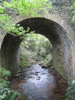 Longford BridgeBridge · 1.3 mi
Explorer Tom Longford Bridge is telling stories about a cow that tried to buy it with a single, very large carrot in exchange for…
 Assaroola BridgeBridge · 1.6 mi
Explorer Tom Assaroola Bridge is letting the local sheep have their say about its tiny arch. The animals think it’s too small for…
 Earthwork in ArdrahinEarthwork · 1.8 mi
Explorer Tom Earthwork in Ardrahin has a massive drama going on with the nearest tree. They’re arguing about who gets to look taller…
 Stagdale BridgeBridge · 1.9 mi
Explorer Tom Stagdale Bridge in Ballycrehane would explain the 1800s to a teenager by saying 'it was basically just us building…
 CarrignabinniaMountain / peak · 2.0 mi
Explorer Tom Carrignabinnia is the Galtees' trick question: after you have marched uphill expecting a triumphant point, its 822…
 LyracappulMountain / peak · 2.1 mi
Explorer Tom Lyracappul sits on the western Galtee ridge in County Limerick, a splendid name for a mountain that has no interest in…
 Lisvernane, AherlowGAA ground · 2.1 mi
More archaeology and monuments in County Limerick · All of County Limerick

What do you know about this place?Tap to add a comment or ask a question