Places near here
Photo credits
- National Inventory of Architectural Heritage
- Sitomon, Wikimedia Commons · CC BY-SA 2.0
- Kieran Campbell, Geograph · Creative Commons Attribution-ShareAlike 2.0
- Wanfried-Dublin, Wikimedia Commons · CC BY-SA 4.0
- Olivier BEZES, Wikimedia Commons · CC BY 2.5
- Garry Dickinson, Geograph · CC BY-SA 2.0
- Jamie Carroll, Geograph · CC BY-SA 2.0
- jai, Wikimedia Commons · CC BY-SA 2.0
- Sitomon, Wikimedia Commons · Public domain
- Colin Park, Geograph · CC BY-SA 2.0
- Jan van Huchtenburgh, Wikimedia Commons · Public domain
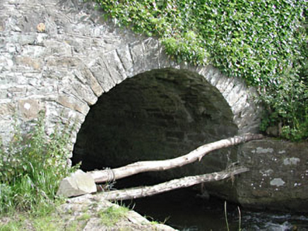 bridge1.2 mi
Explorer Tom Bridge in Benjerstown has strict rules: no jumping, no wading, and absolutely no asking for refunds. It’s just a simple…
 milestone/milepost1.2 mi
Explorer Tom Milestone or milepost in Begsreeve is in a rivalry with a more famous stone that never won. It’s just standing there…
 European Yew2.1 mi
Explorer Tom This European Yew is feuding with the next village over something daft, probably about who has the better shade. It’s…
 Grave YardGraveyard · 2.1 mi
Explorer Tom Graveyard in Knock wants a New Year’s resolution: to stop being so rectangularly boring and start acting mysterious…
 Druids AltarPortal tomb · 2.1 mi
Explorer Tom Druids Altar in Rathkenny hosted a fiddler who played all night without stopping. The music was so good the stones…
 Lebanon Cedar4.1 mi
Explorer Tom This Lebanon Cedar has an ongoing feud with the rain, complaining that it gets in its hair too much. It’s dramatic…
 CastleCastle, tower house · 4.3 mi
Explorer Tom Smarmore Castle thinks tourists from Dublin are too loud and don’t know how to hold a pint. It has modern windows…
 Slane CastleCastle, unclassified · 7.0 mi
Explorer Tom Slane Castle looks tough enough to survive a zombie attack by just standing there and judging everyone. It’s had a few…
 Mellifont AbbeyVisitor attraction · 8.7 mi
Explorer Tom Mellifont Abbey in County Louth was nearly sold to pay for a horse that ran off with a nun. The monks were furious but…
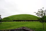 KnowthArchaeological place · 9.4 mi
Explorer Tom You see one mound? Give Knowth another minute to complicate your day. Knowth looks like one enormous grassy mound in…
 Battle of the Boyne Visitor CentreMuseum · 11 mi
Explorer Tom At Oldbridge beside the River Boyne, the land is green and peaceful enough to make 1690 feel impossibly far away, until…
_tussen_Jacobus_II_en_Willem_III,_12_juli_1690_Rijksmuseum_SK-A-605.jpeg/250px-De_slag_aan_de_Boyne_(Ierland)_tussen_Jacobus_II_en_Willem_III,_12_juli_1690_Rijksmuseum_SK-A-605.jpeg "Photo: Jan van Huchtenburgh, Wikimedia Commons · Public domain") Battle of the BoyneMajor battlefield · 11 mi
Battle of the BoyneMajor battlefield · 11 miExplorer Tom The Battle of the Boyne would have a dating profile saying 'Lover of cannon fire, seeking someone who won't run away…
More archaeology and monuments in County Meath · All of County Meath

What do you know about this place?Tap to add a comment or ask a question