
What is recorded here
From the National Monuments Service (Archaeological Survey of Ireland) record CO089-056
Places near here
Photo credits
- Maker not stated on source page, en.wikipedia.org
- Maker not stated on source page, it.pinterest.com
- National Inventory of Architectural Heritage
- Maker not stated on source page, www.flickr.com
- Maker not stated on source page, tr.pinterest.com
- Kmcnamee, Wikimedia Commons · CC BY-SA 4.0
- Maker not stated on source page, readymap.irish
- Maker not stated on source page, www.tripadvisor.com.ph
- Tim FitzGerald, Geograph · CC BY-SA 2.0
- Tim FitzGerald, Wikimedia Commons
 Church in CarrigkilterChurch · 922 yd
Explorer Tom Church in Carrigkilter is an early church site where the exact location isn't known, so you’re basically guessing your…
 Fairy fort / earthen ringfort in CarrigkilterFairy fort / earthen ringfort · 922 yd
Explorer Tom Fairy fort / earthen ringfort in Carrigkilter has a secret talent for disappearing when you least expect it to be…
 sign post1155 yd
Explorer Tom Sign post in Churchtown has been guiding lost souls since 1940 with its rounded corners and serious face. The harp is…
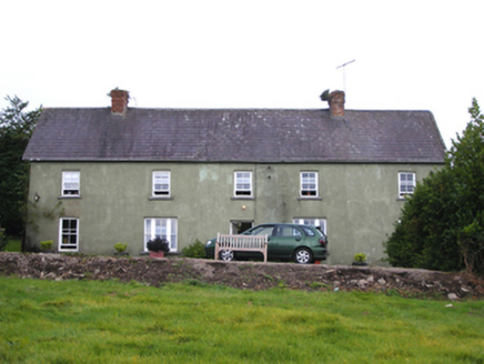 SnugboroughFarm house · 1196 yd
Explorer Tom Snugborough in Ballybraher has a long face and a steep roof, like it’s perpetually frowning at the sky. The builder was…
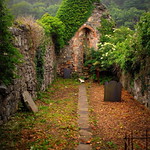 Church (in Ruins)Church · 1321 yd
Explorer Tom Church in Churchtown in County Cork looks like it’s been rebuilt a few times because it had an identity crisis in the…
 Ballygeanymore HouseCountry house · 1488 yd
Explorer Tom Ballygeanymore House would win a county fair prize for 'Most Confusing Architectural Choices.' That huge chimneystack…
 Fairy fort / earthen ringfort in BallycatooFairy fort / earthen ringfort · 1566 yd
Explorer Tom Fairy fort / earthen ringfort in Ballycatoo was recorded by Power in 1940, but now we don’t know where it is. It’s just…
 Russell Rovers GAA pitchGAA ground · 2.0 mi
 Kilmahon CemeteryCemetery · 2.2 mi
Explorer Tom Kilmahon Cemetery in County Cork has a curse that only affects people who forget to wave when they enter. You’ll trip…
 CastleCastle, unclassified · 2.5 mi
Explorer Tom Castle in Ballycroneen West is where a poet fell into the ditch while trying to write a sonnet about the view, which…
 Ballybrannigan BeachBeach / strand · 3.1 mi
Explorer Tom Ballybrannigan Beach is an East Cork strand that local dog walkers seem to have known about long before the rest of us…
 Inch Strand, WhitegateSurfing beach · 5.3 mi
Explorer Tom Inch Strand near Whitegate opens a sweep of sand where the waves have persuaded a surf school to set up shop. Fáilte…
More archaeology and monuments in County Cork · All of County Cork

What do you know about this place?Tap to add a comment or ask a question