What is recorded here
Aerial photograph (GB89.AB.10) shows cropmark of a circular enclosure defined by a fosse; an incomplete curvilinear enclosure (TN047-121) is located immediately to the north-east. First recorded as a positive cropmark in July 1989. On a/p GB89.AB.09 the River Suir is just visible bottom left of photograph. on vertical a/p backdrop to ASI website note two parallel fosses running NE to SE which appear to align with this enclosure - significance uncertain. The above report has been compiled by Dr. G.F. Barrett and supplied to the Archaeological Survey of Ireland.
Aerial photograph (GB89.AB.10) shows cropmark of a circular enclosure defined by a fosse; an incomplete curvilinear enclosure (TN047-121) is located immediately to the north-east. First recorded as a positive cropmark in July 1989. On a/p GB89.AB.09 the River Suir is just visible bottom left of photograph. on vertical a/p backdrop to ASI website note two parallel fosses running NE to SE which appear to align with…
From the National Monuments Service (Archaeological Survey of Ireland) record TN047-120
The monument record does not grant public access. Check the route and ask the landowner before entering private land.
- What survives
- Recorded monument
Places near here
Photo credits
- National Inventory of Architectural Heritage
- Mike Searle, Wikimedia Commons · CC BY-SA 2.0
- Mike Searle, Geograph · CC BY-SA 2.0
- Lár na Páirce Museum, Wikimedia Commons · CC BY 2.0
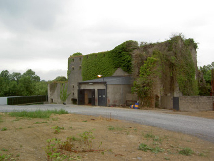 Holycross DistilleryMill (water) · 161 yd
 Holycross HousePresbytery/parochial/curate's house · 365 ydAbbey WellHoly well · 490 ydEnclosure in HolycrossEnclosure · 560 ydCormackstown Heritage CentreMuseum · 1.8 miKillough Hill (site of)Mountain / peak · 2.4 miWildlife CorridorWood · 3.2 miWoodlandWood · 3.6 mi
 Black CastleCastle, tower house · 3.8 mi
 Black CastleCastle · 3.8 mi
 Lár na PáirceMuseum · 3.8 miClonoulty HillMountain / peak · 4.4 mi
More archaeology and monuments in County Tipperary · All of County Tipperary
What do you know about this place?