What is recorded here
Just below crest of hill on a S-facing slope in hilly, undulating terrain, in pasture. A stream runs NW-SE c. 20m to the E, with the ground dropping downslope from the outer edge of the monument. The slope levels off for the S portion of the monument and beyond for a further c. 20m before dropping downhill. The land also drops away to the W. Views upslope to the N are impeded by crest of slope and by the house as well as outbuildings and trees associated with it. Views E are limited by a low hill on the opposite side of the stream. From SE-S-W there is a panoramic view, with a long hill to the S, a plain to the WSW and another long ridge to the W.
An oval enclosure (diam. 60.6m N-S; 50.5m E-W) visible on satellite imagery (Google Earth, imagery date 30 November 2009 and 14 November 2019), as a cropmark of a fosse, identified and reported by Jean-Charles Caillère. The enclosure is defined by a much denuded bank (int. H 0.39m; ext. H 0.45m; Wth at crest c. 2.7m; overall Wth c. 5.6m) and fosse (Wth 3.7m; D 0.49m) in the NE sector, while elsewhere the bank is reduced to scarp (H 0.28-0.46m) with a fosse (Wth c. 2-2.8m; D 0.04-0.36m). The interior slopes downhill with the natural incline. The outer edge of the bank and the fosse in the NW sector is truncated by the S boundary of the yard associated with the house.
See attached:
TN017-092----_01 Google Earth image (imagery date 30 November 2009)
TN017-092----_02 Google Earth image (imagery date 14 November 2019)
TN017-092----_03 From W looking NE
TN017-092----_04 From W looking N
TN017-092----_05 From W looking S
Compiled by: Jean Farrelly
Date of upload: 5 December 2022
A local fairy fort (ringfort/rath); wider significance not recorded.
The monument record does not grant public access. Check the route and ask the landowner before entering private land.
- What survives
- Recorded monument
Places near here
 Patricks WellHoly well · 530 yd
 Enclosure in CamlinEnclosure · 775 yd
 Kiln in CamlinKiln · 1464 yd
 Castle in ruinsHouse, fortified house · 1.2 mi
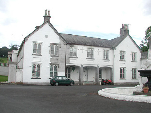 Inane Housecountry house · 1.2 mi
 CastleCastle, unclassified · 1.5 mi
 Roscrea Petty Sessions HouseHeritage attraction · 2.3 mi
 European ashEuropean ash · 2.6 mi
 European YewEuropean Yew · 3.0 mi
 Millennium GardenMemorial · 3.3 mi
 Black HillMountain / peak · 3.3 mi
 Golden Grove HillMountain / peak · 4.2 mi
Other information
Photo: Credit not shown in the picture search · Rights wording not checked; contact us if this picture should be removed