What is recorded here
Visible as a circular feature on aerial images OSI (2010), Bing (c. 2013) and Google Earth (2005), but not on earlier series such as OSI (1995, 2000). It is situated on a level landscape, and its construction c. 2005 as a very good imitation rath is confirmed locally. Circular grass-covered area (diam. 21m) defined by a flat-topped earthen bank (Wth of base 4.7-5.5m; int. H 0.7m; ext. H 0.7-0.8m) with no fosse. There is an entrance gap (Wth of top 4.5m; Wth of base 1.3m) at NE.
Visible as a circular feature on aerial images OSI (2010), Bing (c. 2013) and Google Earth (2005), but not on earlier series such as OSI (1995, 2000). It is situated on a level landscape, and its construction c. 2005 as a very good imitation rath is confirmed locally. Circular grass-covered area (diam. 21m) defined by a flat-topped earthen bank (Wth of base 4.7-5.5m; int. H 0.7m; ext. H 0.7-0.8m) with no fosse.…
From the National Monuments Service (Archaeological Survey of Ireland) record ME023-024
The monument record does not grant public access. Check the route and ask the landowner before entering private land.
- What survives
- Recorded monument
Places near here
Photo credits
- National Inventory of Architectural Heritage
- Garry Dickinson, Geograph · CC BY-SA 2.0
FarmaphobiaHeritage attraction · 266 ydCausey FarmHeritage attraction · 296 yd Catholic Church of the Immaculate ConceptionChurch/chapel · 431 ydCross (part of)Cross, High cross · 512 ydSt. Margaret's Church Girley (C of I) site ofArchaeological place · 640 ydCastleCastle, motte · 896 ydNative Woodland Trust: Girley Bog ReserveWood · 1111 ydGirley WoodWood · 1341 ydBoglandMemorial · 1570 ydDrewstown HouseDemesne walls/gates/railings · 1.6 miDrewstown LittleMountain / peak · 1.8 miCastleCastle, motte · 2.3 mi
 Catholic Church of the Immaculate ConceptionChurch/chapel · 431 ydCross (part of)Cross, High cross · 512 ydSt. Margaret's Church Girley (C of I) site ofArchaeological place · 640 ydCastleCastle, motte · 896 ydNative Woodland Trust: Girley Bog ReserveWood · 1111 ydGirley WoodWood · 1341 ydBoglandMemorial · 1570 yd
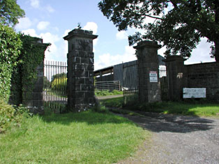 Drewstown HouseDemesne walls/gates/railings · 1.6 miDrewstown LittleMountain / peak · 1.8 mi
 CastleCastle, motte · 2.3 mi
More archaeology and monuments in County Meath · All of County Meath
What do you know about this place?