What is recorded here
A small roughly triangular field (dims. c. 174m NE-SW; c. 70m NW-SE) of scrub and rough pasture surrounded by tillage. An enclosure is indicated in this field on a map by Ellen Prendergast (OPW files). It is not indicated on the 1st (1839) OS 6-inch map or on the 1900 revision.
From the National Monuments Service (Archaeological Survey of Ireland) record KK021-009
The monument record does not grant public access. Check the route and ask the landowner before entering private land.
- What survives
- Recorded monument
Places near here
Photo credits
- National Inventory of Architectural Heritage
- liam murphy, Geograph · Creative Commons Attribution-ShareAlike 2.0
- Zapp111, Wikimedia Commons · CC BY-SA 4.0
- Wanfried-Dublin, Wikimedia Commons · CC BY-SA 4.0
- A.-K. D., Wikimedia Commons · CC0
- A.-K. D., Wikimedia Commons · CC BY-SA 4.0
- Ronnie Nijboer, Wikimedia Commons · CC0
- Miguel Angel Masegosa Martínez, Wikimedia Commons · CC BY 2.0
- Poleary91, Wikimedia Commons · CC BY-SA 4.0
- Mike Searle, Wikimedia Commons · CC BY-SA 2.0
 Duninga HouseGates/railings/walls · 450 yd
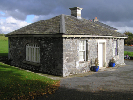 Duninga HouseGate lodge · 462 yd
 Grave YardGraveyard · 1.8 mi
 Church (in ruins), GraveyardChurch · 1.8 mi
 Cloghabrona Druids AltarPortal tomb · 2.1 mi
 Lock Keeper's House and Lodge MillsVisitor information · 2.6 mi
 The Columban WayVisitor information · 2.8 mi
 Wych Elm3.1 mi
 Sweet Chestnut3.8 mi
 Ballymoon Castle (in ruins)Castle, Anglo-Norman masonry castle · 4.2 mi
_-_geograph.org.uk_-_8100379.jpg/250px-Castles_of_Leinster,_Ballyshawnmore,_Kilkenny_(1)_-_geograph.org.uk_-_8100379.jpg "Photo: Mike Searle, Wikimedia Commons · CC BY-SA 2.0") Ballyshanemore Cas. (in ruins)Castle, tower house · 4.4 mi
Ballyshanemore Cas. (in ruins)Castle, tower house · 4.4 mi Church, GraveyardChurch · 4.4 mi
More archaeology and monuments in County Kilkenny · All of County Kilkenny
What do you know about this place?