What is recorded here
In 1997 quarrying operations at Derryvilla unearthed human remains which after examination was revealed to belong to a large unrecorded burial ground. This burial round was situated on top of a hill with good views in all directions. An earthen track known as 'The Friar's Togher' (OF034-001----) is located immediately S of the hill and is orientated on a N-S axis and appears to be connecting this hilltop containing the burial ground with an area to the S of the hill. An arcaheological evaluation of this burial ground was undertaken by Clare Mullins under licence No. 98 E 0315 between 20-31 July 1998. A total of 22 test trenches were opened on the west and northwest side of the hilltop. Within trench 19 a ditch was discovered running NE-SW at a depth of 0.2m below the topsoil and consisted of a continuous layer of of dark brown silty sand which had moderate amounts of charcoal fleck. This in turn overlay the upper fill of the ditch which consisted of a dark brown/black silty sand with occasional angular stones and occasional inclusions of animal bone as well as frequent charcoal flecks. This external ditch measured 2.8m in width and 0.6m deep with possible internal ditch measuring 1.2m wide by 0.4m deep. In trech 16 the remains of this enclosing ditch were found at the NW end of this ditch, a shard of what has tentatively been described as medieval pottery was found at the topsoil/brown sand interface. This ditch feature appears to run from NE-SW across the platform possibly acting as an enclosing element for the burials that can be found on the E side of the ditch and which are totally absent from the W side of the ditch. In total burials, either disturbed or in situ, were found in 11 of these test trenches. Trenches 21 and 22 were located in an area outside of the burial ground. All undisturbed burials, with the exception of that found in Trench 10, were orientated precisely or closely E-W with the head to the W indicating that the burial ground belongs to the Christian era (Mullins 1998, 9). On the basis of the evidence revelaed during the archaeological evaluation of the site it would seem most probable that the remaining part of the burial ground is confined to the E part of the hilltop on the N side of the quarry. The feature revealed in Trench 19 and Trench 16 most likley represents a ditch which delineated the boundary of the burial ground. 5/2000).
In 1997 quarrying operations at Derryvilla unearthed human remains which after examination was revealed to belong to a large unrecorded burial ground. This burial round was situated on top of a hill with good views in all directions. An earthen track known as 'The Friar's Togher' (OF034-001----) is located immediately S of the hill and is orientated on a N-S axis and appears to be connecting this hilltop…
From the National Monuments Service (Archaeological Survey of Ireland) record OF034-008002
The monument record does not grant public access. Check the route and ask the landowner before entering private land.
- What survives
- Recorded monument
Places near here
Burial ground in DerryvillaBurial ground · 111 ydDerryounce Walk (Yellow Loop)Walking route · 526 ydBog Lake WalkWalking route · 570 yd Portarlington Parochial HallChurch/chapel · 1.2 miPortarlington Market HouseMarket house · 1.2 miLea Castle (in ruins)Castle, Anglo-Norman masonry castle · 2.1 miChurch (in Ruins), GraveyardChurch · 2.7 miPedunculate Oak3.3 miWych Elm4.2 miEmo CourtFolly · 4.4 miTinnakill Castle (in Ruins)Castle, tower house · 4.5 miEmo CourtBuilding misc · 4.9 mi
 Portarlington Parochial HallChurch/chapel · 1.2 mi
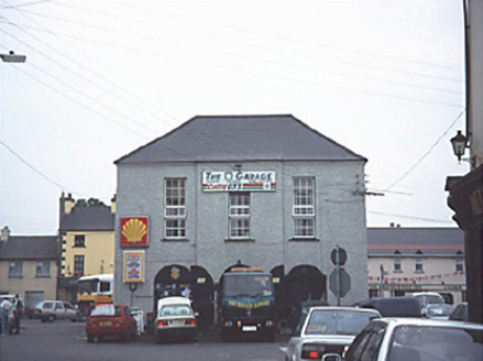 Portarlington Market HouseMarket house · 1.2 mi
 Lea Castle (in ruins)Castle, Anglo-Norman masonry castle · 2.1 miChurch (in Ruins), GraveyardChurch · 2.7 mi
 Pedunculate Oak3.3 mi
 Wych Elm4.2 mi
 Emo CourtFolly · 4.4 mi
_(geograph_6506412).jpg/250px-Castles_of_Leinster-_Tinnakill,_Laois_(2)_(geograph_6506412).jpg "Photo: Garry Dickinson, Wikimedia Commons · CC BY-SA 2.0") Tinnakill Castle (in Ruins)Castle, tower house · 4.5 mi
Tinnakill Castle (in Ruins)Castle, tower house · 4.5 mi Emo CourtBuilding misc · 4.9 mi
Pictures: Trenchspike, Wikimedia Commons · CC BY-SA 4.0; National Inventory of Architectural Heritage; Mike Searle, Wikimedia Commons · CC BY-SA 2.0; Algirdas at Lithuanian Wikipedia, Wikimedia Commons · Public domain; Ronnie Nijboer, Wikimedia Commons · CC0; Mike Searle, Geograph · CC BY-SA 2.0; Garry Dickinson, Wikimedia Commons · CC BY-SA 2.0; Colin Park, Geograph · CC BY-SA 2.0
More archaeology and monuments in County Offaly · All of County Offaly
What do you know about this place?