What is recorded here
In pasture, located on the summit of a steep-sided ENE–WSW ridge. Slightly raised, oval area (44.8m N–S; 56.5m E–W) defined by a scarp, and enclosed at WSW–E by a fosse with remnants of an external bank. The enclosure encompasses almost the full N-S width of the ridge top. The enclosing scarp (H 0.5- 0.7m at W–E,…
Read the whole record
From the National Monuments Service (Archaeological Survey of Ireland) record DG100-019
Places near here
Photo credits
- louise price, Geograph · Creative Commons Attribution-ShareAlike 2.0
- National Inventory of Architectural Heritage
- Maker not stated on source page, commons.wikimedia.org
- Maker not stated on source page, www.tuatha.ie
- Thielfer, Wikimedia Commons · CC BY-SA 4.0
- Maker not stated on source page, en.wikipedia.org
- Maker not stated on source page, stock.adobe.com
- Maker not stated on source page, www.thepantry.nl
- Maker not stated on source page, ru.dreamstime.com
- Golfing in Ireland; photographer not stated, Source publisher
 Cuilly Orange HallOrange Hall · 341 yd
Explorer Tom Cuilly Orange Hall looks exactly like a tiny chapel that got lost! Built in 1907, I wonder if the windows were pointed…
 Ballykillowen BridgeBridge · 666 yd
Explorer Tom Ballykillowen Bridge is hiding behind all that vegetation because it thinks the bishop refused to visit out of sheer…
 Megalithic tomb in Golard,moyneMegalithic tomb · 1011 yd
Explorer Tom Megalithic tomb in Golard, Moyne is currently hiding behind a lack of uploaded information, so I’m stuck with just the…
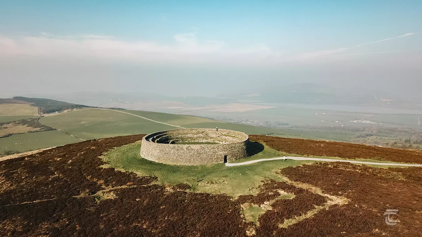 Raneany East Large Fairy FortFairy fort / earthen ringfort · 1.1 mi
Explorer Tom Raneany East Large Fairy Fort is where a smuggler tried to hide a shipment of cheese and got stuck in the mud for a…
 Raneany Presbyterian ChurchChurch/chapel · 1.1 mi
Explorer Tom Raneany Presbyterian Church is remembering the matchmaker who used to work there, pairing up singletons during Sunday…
 farm house, house1.3 mi
Explorer Tom House in Drummenny Middle has block-and-start quoins that look like they're playing a very serious game of tic-tac-toe.…
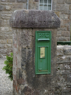 post box1.6 mi
Explorer Tom The Post box in Copany claims to hold the unofficial world record for 'Most Patience Per Litre of Cast Iron,' which is…
 Standing stoneStanding stone, pair · 1.6 mi
Explorer Tom Standing stone in Clarcarricknagun is a pair, which is a rare treat for any explorer. The name sounds like it belongs…
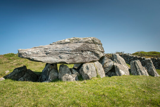 Court tomb in DrumratCourt tomb · 1.6 mi
Explorer Tom Court tomb in Drumrat is buried under a new road near Donegal town, a total vanishing act for archaeology. They pulled…
 The Pantry RestaurantRestaurant · 2.0 mi
Explorer Tom The Pantry Restaurant sounds like it stores food rather than serving it, but after a few pints it would tell you the…
 Donegal Union Workhouse GraveyardGraveyard · 2.2 mi
Explorer Tom Donegal Union Workhouse Graveyard started because two lads made a bet in the pub about who could find the coldest patch…
 Letterkenny Golf ClubGolf course · 2.3 mi
More archaeology and monuments in County Donegal · All of County Donegal

What do you know about this place?Tap to add a comment or ask a question