What is recorded here
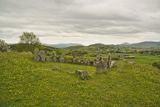
Enclosure in Creggan Upper is an enclosure in County Armagh, Ireland.
From the Northern Ireland Sites and Monuments Record record ARM021:020
The monument record does not grant public access. Check the route and ask the landowner before entering private land.
- What survives
- Recorded monument
Places near here
 Lurgana HouseHouse · 1682 yd
 Ballymoyer WoodWood · 1.0 mi
 St. Teresa's ChurchChurch · 1.3 mi
 Post-med Church; Graveyard: Ballymoyer Old Church or Lisdromaude in BallintemplePost-med Church · 1.9 mi
 Drumilly MountainMountain / peak · 3.2 mi
 War MemorialMonument · 3.7 mi
 BessbrookVisitor information · 3.7 mi
 BessbrookVisitor information · 3.9 mi
 Sturgan MountainMountain / peak · 3.9 mi
 Canal WoodWood · 4.9 mi
 Newry Canal WayWalking route · 6.2 mi
 Ballymacdermott Court TombArchaeological place · 6.4 mi
Pictures: Eric Jones, Wikimedia Commons · CC BY-SA 2.0; Eric Jones, Geograph · CC BY-SA 2.0; P Flannagan, Wikimedia Commons · CC BY-SA 2.0; Dean Molyneaux, Geograph · CC BY-SA 2.0; P Webb, Geograph · CC BY-SA 2.0; Andrew Mcmillan, Wikimedia Commons · CC BY 3.0
More archaeology and monuments in County Armagh · All of County Armagh
What do you know about this place?