What is recorded here
In low-lying flat marshy pasture. Monument, depicted as penannular enclosure (diam. c. 15m) on 1841 OS 6-inch map, has been levelled. No trace of monument evident when inspected. Low linear earthen bank (Wth 3.8m; H 0.6m; L 10.5m E-W) noted in area of site, c. 4m W of removed field boundary, may be part of ancient field-boundary system.
From the National Monuments Service (Archaeological Survey of Ireland) record LI028-158
The monument record does not grant public access. Check the route and ask the landowner before entering private land.
- What survives
- Recorded monument
Places near here
Photo credits
- National Inventory of Architectural Heritage
- Mike Searle, Geograph · CC BY-SA 2.0
- Willow, Wikimedia Commons · CC BY 2.5
- Created by Kglavin Modified Aug 2007 by Mike Christie, Wikimedia Commons · CC BY-SA 3.0
- A.-K. D., Wikimedia Commons · CC BY-SA 4.0
- Vadim Manuylov, Wikimedia Commons · CC BY-SA 3.0
 Reens HouseHouse · 674 ydKyle Burial GroundChildren's burial ground · 799 yd
 Elm HillCountry house · 1760 yd
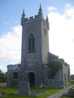 Kilscannell ChurchChurch/chapel · 1.0 mi
 bridge1.4 miSt. Kieran's WellSpring · 1.6 mi
 European ash2.1 mi
 Ardagh FortArchaeological place · 2.6 mi
 Castle MatrixCastle · 2.9 mi
 Castle MatrixCastle, tower house · 2.9 mi
 Saint Ite's WellSpring · 7.9 mi
 Monterey Cypress10 mi
More archaeology and monuments in County Limerick · All of County Limerick
What do you know about this place?