
What is recorded here
Situated on a slight rise, in gently undulating pasture. Ringfort (WM025-136----) lies c. 65m to SE. A circular earthwork outlined by a scarp with a long L-shaped ruin in the interior , annotated 'fort' on the 1837 OS Fair Plan map. Monument described in 1971 as an earthwork known locally as the ‘little fort’ which is located in the W corner of the field which contains ringfort (WM025-136----). According to local information this monument was levelled a number of years ago. The land has been drained recently and many small stones are scattered across the site.
From the National Monuments Service (Archaeological Survey of Ireland) record WM025-135
Places near here
Photo credits
- National Inventory of Architectural Heritage
- Abi Skipp, Wikimedia Commons · CC BY 2.0
- Willow, Wikimedia Commons · CC BY 2.5
- Bridget Neville, Wikimedia Commons · CC BY-SA 4.0
- Mike Searle, Geograph · CC BY-SA 2.0
- kevin higgins, Wikimedia Commons · CC BY-SA 2.0
- Maker named on the Wikimedia Commons picture page · CC BY-SA 2.5
 Castletown Railway StationStore/warehouse · 1055 yd
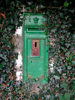 post box1128 yd
 Saint Michael's CemeteryGraveyard/cemetery · 1157 yd
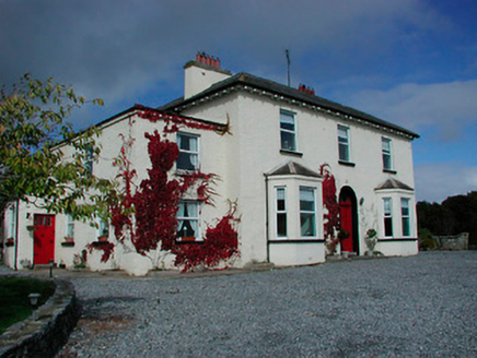 Conranstown HouseHouse · 1159 yd
 Hill of UisneachMountain / peak · 3.4 mi
 European ash3.9 mi
 Brides WellHoly well · 3.9 mi
 Laragh CastleCastle · 4.7 mi
 Durrow MoatCastle, motte · 8.9 mi
Explorer Tom Durrow Moat is deeply suspicious of the postman and hides its head under the earth. Hugh de Lacy died there, so don't get too comfortable. Tell it a joke, it's been a long time since anyone did.
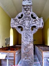 St. Columbkilles CrossCross, High cross · 8.9 mi
Explorer Tom St. Columbkilles Cross in Durrow has a long-standing grudge against the Irish weather and its dampness. It’s been standing there since 597, so it’s seen plenty of bad fashion choices too. Have a sandwich here and call it a heritage lunch.
 Durrow High CrossVisitor attraction · 8.9 mi
 Sessile Oak9.1 mi
More archaeology and monuments in County Westmeath · All of County Westmeath

What do you know about this place?Tap to add a comment or ask a question