
What is recorded here
In pasture, on gentle NE-facing slope. Subcircular area (81m NW-SE; 67.5m NE-SW) enclosed by earthen bank (H 1.9m) with shallow external fosse to W (max. D 0.3m). Bank to NE widens; break (Wth 20m) ENE->E corresponds to small rectangular extension marked at E side of enclosure on 1842 OS 6-inch map, incorporating lime…
Read the whole record
From the National Monuments Service (Archaeological Survey of Ireland) record CO006-053
Places near here
Photo credits
- Maker not stated on source page, ie.polomap.com
- Maker not stated on source page, www.pinterest.com
- National Inventory of Architectural Heritage
- Maker not stated on source page, www.tripadvisor.ca
- Kmcnamee, Wikimedia Commons · CC BY-SA 4.0
- Maker not stated on source page, www.dreamstime.com
- Maker not stated on source page, www.rte.ie
- Maker not stated on source page, it.pinterest.com
 Deliga CemeteryCemetery · 1.5 mi
Explorer Tom Deliga Cemetery in County Cork gets its name from a word that means 'slightly damp and regretful,' according to my…
 Church in KeeltaneChurch · 1.5 mi
Explorer Tom Church in Keeltane is a rectangular raised area with a long list of former names it can't remember. It’s 90 square…
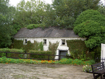 Coolbane MillMill (water) · 1.5 mi
Explorer Tom Coolbane Mill has a cast-iron wheel that looks like it’s about to start spinning again. Built in 1850, it ground corn…
 FortwilliamCountry house · 1.7 mi
Explorer Tom Fortwilliam in Ballagharea is a disused Tudor Revival mess designed by the guy who built Tower Bridge. It’s got timber…
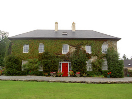 Tullylease HouseCountry house · 1.7 mi
Explorer Tom Tullylease House in Tullylease, County Cork, was the seat of the Sullivan family and has a Greek Revival doorcase that…
 Church in Coolbane (duhallow By., Tullylease Par.)Church · 1.8 mi
Explorer Tom Church in Coolbane has very strong opinions on modern buildings and thinks they’re all show-offs. There is now no sign…
 Freemount GAA pitchGAA ground · 1.9 mi
 Standing stone in PoulavareStanding stone · 2.1 mi
Explorer Tom Standing stone in Poulavare was recorded by Bowman in 1934 as being nearly four feet high. But nobody knows the exact…
 Kilbeg BridgeBridge · 2.1 mi
Explorer Tom Kilbeg Bridge near Kyle is flexing its staggered arches and cut limestone voussoirs like a bodybuilder at the gym. It’s…
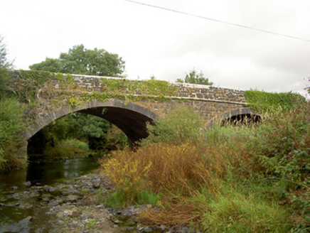 Raheen BridgeBridge · 2.2 mi
Explorer Tom Raheen Bridge in Muckenagh has a finely executed limestone finish that would make a mason weep with joy or envy. It…
 Deel Rovers GAA pitchGAA ground · 2.9 mi
 Ecclesiastical enclosure in Bawnmore NorthEcclesiastical enclosure · 4.8 mi
Explorer Tom Ecclesiastical enclosure in Bawnmore North is heart-shaped, which is either romantic or just a very weird hill that got…
More archaeology and monuments in County Cork · All of County Cork

What do you know about this place?Tap to add a comment or ask a question