What is recorded here
In pasture, located on the top of a ridge. Ground falls away in a steep slope to E and more gradually to SE−S. Ground rises again further S to a ridge top on which a portal tomb (SL007-026----) is located 275m to SSW. Views are good to N over undulating terrain, and extensive to E, where a rath (SL007-021001-) is visible on a ridge c. 600m to E, with Drumcliff Bay beyond. Gently rising ground restricts views to W. There is a farmyard at the base of the slope immediately to S. According to local information, this is the site of an enclosure, and the location was traditionally known as the ‘fort field’. It is not indicated on OS 6-inch maps. Little remains of the enclosure. A shallow arc of field fence/bank is extant, merging at its SW and NE ends with straight field fences, and coinciding with the boundary between Cloghcor and Cloghboley townlands. It may preserve the W half of a roughly circular enclosure (diam. 15-20m). It is engulfed in overgrowth and difficult to examine. It appears to consist of a curving bank (Wth c. 2-3m; int. H c. 1m; ext. H 1.6m) of earth and stone with a broad slump on the W side. The E face is cut to the vertical and faced with stones. Although clearly been modified to serve as a boundary fence, it is noticeably more substantial than the adjoining straight field fences. The E half of the enclosure probably coincided with the natural coutour/break of slope of the hill, but no trace of an enclosing element is now visible on that side. In the early 1990’s, a rectangular hearth-like feature (L c 2m; Wth c.1m) was exposed in the interior area of the enclosure during ground works to create a farm track. It was defined by a setting of low rectilinear stones, and containing black soil. Three fragments representing approximately three-quarters of a rotary quern stone were found in the hearth-like feature. One fragment had a small, rough cross incised on it. The whereabouts of the quern fragments are now unknown (pers. comm. Leo Leydon). Notified to NMS by Leo Leydon. Attached images:
SL007-056----_01.JPG: Location viewed from S
SL007-056----_02.JPG: Arc of bank viewed from W
SL007-056----_03.JPG: Arc of bank viewed from WNW
Compiled by: Jane O’Shaughnessy
Date of upload: 13 August 2021
In pasture, located on the top of a ridge. Ground falls away in a steep slope to E and more gradually to SE−S. Ground rises again further S to a ridge top on which a portal tomb (SL007-026----) is located 275m to SSW. Views are good to N over undulating terrain, and extensive to E, where a rath (SL007-021001-) is visible on a ridge c. 600m to E, with Drumcliff Bay beyond. Gently rising ground restricts views to…
From the National Monuments Service (Archaeological Survey of Ireland) record SL007-056
The monument record does not grant public access. Check the route and ask the landowner before entering private land.
- What survives
- Recorded monument
Places near here
Druid's AltarArchaeological place · 322 ydLissgallonFairy fort / stone ringfort · 721 yd Ardtarmon HouseCountry house · 725 ydJohn's PortBuilding misc · 1163 ydBawn in ArdtermonBawn · 1450 ydArdtermon StrandBeach / strand · 1.0 miBawn in DoonforeBawn · 1.3 miForester's WoodForest · 1.7 miYellow StrandBeach / strand · 1.7 miChurch Hill WoodWood · 1.7 miCoastguard StationRuins · 1.9 miDrumcliff BayBay · 2.1 mi
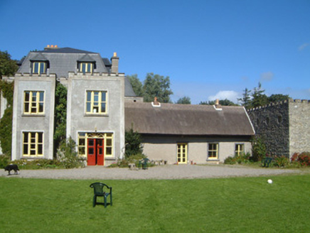 Ardtarmon HouseCountry house · 725 yd
 John's PortBuilding misc · 1163 yd
 Bawn in ArdtermonBawn · 1450 yd
 Ardtermon StrandBeach / strand · 1.0 miBawn in DoonforeBawn · 1.3 miForester's WoodForest · 1.7 mi
 Yellow StrandBeach / strand · 1.7 miChurch Hill WoodWood · 1.7 miCoastguard StationRuins · 1.9 miDrumcliff BayBay · 2.1 mi
Pictures: National Inventory of Architectural Heritage; Kenneth Allen, Geograph · CC BY-SA 2.0; Oliver Dixon, Geograph · CC BY-SA 2.0
More archaeology and monuments in County Sligo · All of County Sligo
What do you know about this place?