
Places near here
Photo credits
- Mike Searle, Wikimedia Commons · CC BY-SA 2.0
- Wanfried-Dublin, Wikimedia Commons · CC BY-SA 4.0
- Richard Webb, Geograph · Creative Commons Attribution-ShareAlike 2.0
- National Inventory of Architectural Heritage
- Mike Searle, Geograph · CC BY-SA 2.0
- Maker not stated on source page, megalithics.com
- St John's GAA Club Sligo; individual photographer not stated, stjohnsgaaclub.blogspot.com
- Bob Embleton, Wikimedia Commons · CC BY-SA 2.0
- Zxcode / Wikimedia Commons, commons.wikimedia.org
- Andreas F. Borchert, Wikimedia Commons · CC BY-SA 4.0
 Drumcondra Castle (in Ruins)Castle, tower house · 528 yd
Explorer Tom Drumcondra Castle is currently being courted by a cow who thinks it’s a luxury loft. The tower is barely standing, so…
 Giants GraveArchaeological place · 1298 yd
Explorer Tom Giants Grave in County Sligo started because two lads bet fifty quid that they could find a bigger stone than the one…
 Graveyard1324 yd
Explorer Tom Graveyard in Kilross is hiding behind a church ruin, looking like it’s trying to blend into the background of history.…
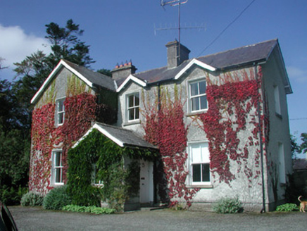 The Old RectoryRectory/glebe/vicarage/curate's house · 1690 yd
Explorer Tom The Old Rectory in Lurgan has a secret talent for juggling multiple gable fronts without looking too busy. It’s got…
 Druids AltarCourt tomb · 1719 yd
Explorer Tom Druids Altar in Carrownagh would survive a zombie attack by just lying down and pretending to be part of the landscape.…
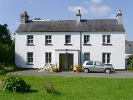 Arnasbrack HouseHouse · 1720 yd
Explorer Tom Arnasbrack House is hiding at the end of a winding driveway, pretending it’s not as posh as it clearly is. It’s got…
 Castle NeymoeCountry house · 1.2 mi
Explorer Tom Castle Neymoe is a romantic ruin in Ballysumaghan, casting an impressive presence with its Gothic style and central…
 Wedge tomb in Carrowcrin (tirerrill By.)Wedge tomb · 1.2 mi
Explorer Tom Wedge tomb in Carrowcrin looks like it's been sitting on that hill for centuries just waiting for someone to explain…
 Ballintogher, St. Michael's GAAGAA ground · 1.4 mi
 Tobernalt Holy WellSpring · 4.0 mi
Explorer Tom Tobernalt Holy Well lies near Lough Gill in County Sligo, where people come to pray, pause and leave the hurry of the…
 Owenmore Gaels GAA pitchGAA ground · 4.0 mi
 The Cailleach: CarrowmoreLegend location · 6.2 mi
Explorer Tom The Cailleach: Carrowmore is a field of ancient tombs with a woman in the stories powerful enough to shape the land…
More archaeology and monuments in County Sligo · All of County Sligo

What do you know about this place?Tap to add a comment or ask a question