
What is recorded here
From the National Monuments Service (Archaeological Survey of Ireland) record CO092-042
Places near here
Photo credits
- Maker not stated on source page, www.alamy.com
- Maker not stated on source page, global-geography.org
- Maker not stated on source page, en.wikipedia.org
- Maker not stated on source page, www.dreamstime.com
- Maker not stated on source page, www.pinterest.com
- Maker not stated on source page, commons.wikimedia.org
- Maker not stated on source page, www.istockphoto.com
- Andrew Wood, Wikimedia Commons · CC BY-SA 2.0
- Willow, Wikimedia Commons · CC BY 2.5
- Richard Webb, Wikimedia Commons · CC BY-SA 2.0
- Gordon Hatton, Geograph · CC BY-SA 2.0
- Colin Park, Geograph · CC BY-SA 2.0
 Fairy fort / earthen ringfort in Cappaboy MoreFairy fort / earthen ringfort · 411 yd
Explorer Tom Fairy fort / earthen ringfort in Cappaboy More is a large raised platform where a goat once ruled with absolute…
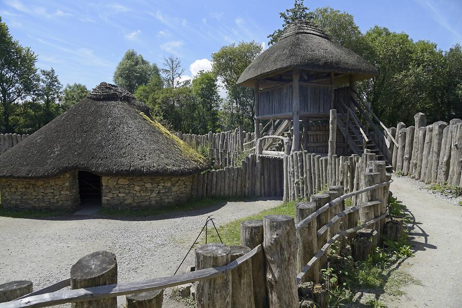 Fairy fort / earthen ringfort in CahermuckeeFairy fort / earthen ringfort · 762 yd
Explorer Tom Cahermuckee’s fort is sitting on a slope overlooking the Owvane River, looking very pleased with itself because it has…
 Stone CircleAnomalous stone group · 987 yd
Explorer Tom Stone Circle in Cappaboy More: It’s actually just an anomalous stone group that no one can find, probably because a…
 Standing stone in MaughanacleaStanding stone · 1.6 mi
Explorer Tom Standing stone in Maughanaclea thinks its secret talent is staring at the horizon until you get awkward. It’s got huge…
 Standing stone in CousaneStanding stone · 2.5 mi
Explorer Tom Standing stone in Cousane would tell a teenager that 1800s was basically Instagram with worse filters. It leans on the…
 Kilmocomoge Church (in Ruins)Church · 4.1 mi
Explorer Tom Kilmocomoge Church in Lisheen has strong opinions about the road that leads to it, mostly that it’s too bumpy. The ivy…
 Kilmocomogue GraveyardGraveyard · 4.1 mi
Explorer Tom Kilmocomogue Graveyard in County Cork is planning its retirement by turning into a very stylish garden center for the…
 Aireagal Naomh Finbarr [Saint Finbarr's Oratory]Church/chapel · 4.5 mi
Explorer Tom Aireagal Naomh Finbarr is on a tiny island at the source of the River Lee. Built in 1903, it’s very Celtic Revival and…
 European ash4.5 mi
Explorer Tom European ash in Cork is terrified of dying young, so it's overthinking everything. If it won the lotto, it would buy a…
 KnockastumpaMountain / peak · 18 mi
Explorer Tom Knockastumpa in County Kerry is home to one stubborn bird that absolutely refuses to leave, despite several offers of…
 Ormond's IslandIslet · 19 mi
Explorer Tom Ormond's Island brags about surviving a storm so huge it claimed the waves were actually giant whales trying to eat it.…
 KnocklomenaMountain / peak · 21 mi
Explorer Tom Knocklomena is famous for having no paths, which means it’s basically a giant tussocky obstacle course for your ankles.…
More archaeology and monuments in County Cork · All of County Cork

What do you know about this place?Tap to add a comment or ask a question