
What is recorded here
From the National Monuments Service (Archaeological Survey of Ireland) record ME016-032
Places near here
Photo credits
- Maker not stated on source page, www.irishamericanmom.com
- Maker not stated on source page, ru.pinterest.com
- National Inventory of Architectural Heritage
- Maker not stated on source page, www.pinterest.com
- Maker not stated on source page, en.wikipedia.org
- Kmcnamee, Wikimedia Commons · CC BY-SA 4.0
 Fairy fort / earthen ringfort in CarrickFairy fort / earthen ringfort · 966 yd
Explorer Tom Fairy fort / earthen ringfort in Carrick has a giant legend that I invented just to make it sound scarier. It’s not on…
 Fairy fort / earthen ringfort in BoltownFairy fort / earthen ringfort · 1103 yd
Explorer Tom Fairy fort / earthen ringfort in Boltown thinks Dublin tourists are all about the Instagram filter and not the actual…
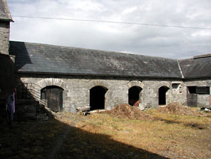 New GroveOutbuilding · 1404 yd
Explorer Tom New Grove in Balnagon Upper would cope on a reality show by complaining about the cobblestones and the lighting. The…
 Standing stone in Balnagon UpperStanding stone · 1.0 mi
Explorer Tom Standing stone in Balnagon Upper smuggled secrets up the hill for centuries. It’s a rectangular limestone upright…
 TombTomb, chest tomb · 1.3 mi
Explorer Tom Tomb in Kilskeer is plotting a grand escape for Hugh Reilly, but the wind keeps getting in his way. He’s been waiting…
 Church (in Ruins)Church · 1.3 mi
Explorer Tom Church in Kilskeer smells like wet wool and ancient regret, which is basically what you get when you mix Saint Scíre’s…
 Stone CrossCross · 1.4 mi
Explorer Tom Stone Cross in Kilskeer is sitting on a tiny cairn next to a whitethorn tree. A local dog has declared himself the…
 Kilskyre GAAGAA ground · 1.4 mi
 Carrick ViewFarm house · 1.4 mi
Explorer Tom Carrick View has limestone door surrounds that look like they’re trying too hard to impress the sheep. The local flock…
 Hill HouseHouse · 1.5 mi
Explorer Tom Hill House in Crossakeel is having a dramatic standoff with the nearest tree over who looks taller. Its ashlar chimneys…
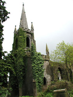 Saint Schiria's Church (Kilskeer)Church/chapel · 1.5 mi
Explorer Tom Saint Schiria's Church (Kilskeer) bragged about surviving a storm in 1890 but lost its roof in the process. It’s now…
Drumbaragh Emmett's GAA pitchGAA ground · 2.3 miMore archaeology and monuments in County Meath · All of County Meath

What do you know about this place?Tap to add a comment or ask a question