What is recorded here
On a flat, low-lying wet valley floor, with good views across the valley. A ringfort (KK009-059----) is located 70m to the NE. Indicated on the 1st (1839) ed. OS 6-inch map as a roughly square enclosure (dims. c. 27m NW-SE; c. 30m NE-SW) with a field boundary running NW-SE along the NE side. On the 1900 revision of this map it is shown as a similarly sized feature but the hachures suggest that it is a depression rather than an enclosure. According to a field visit in 1994 the enclosure was removed during land reclamation and was not longer visible at ground level, however, it appears to be visible on Digitalglobe imagery (viewed 7 February 2018), though the interior is heavily overgrown.
Compiled by: Jean Farrelly
Date of upload: 7 February 2018
A local fairy fort (ringfort/rath); wider significance not recorded.
The monument record does not grant public access. Check the route and ask the landowner before entering private land.
- What survives
- Recorded monument
Places near here
 Belville Ringfort (Rath)Archaeological place · 108 yd
 Kilrush Housegates/railings/walls · 491 yd
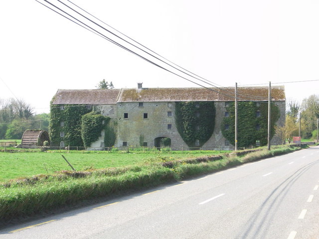 Kilrush Corn Millsmill (water) · 671 yd
 CastleCastle, tower house · 910 yd
 TobernapeastiaHoly well · 1099 yd
 The PondsForest · 1.1 mi
 Balleen Castle (ruins)Castle · 1.1 mi
 Freshford LoopWalking route · 1.3 mi
 The CopseWood · 1.4 mi
 Emma Jane Browne-ClaytonMemorial · 1.6 mi
 Clomantagh HillMountain / peak · 3.1 mi
 John HelyMemorial · 5.0 mi
Other information
Photo: Credit not shown in the picture search · Rights wording not checked; contact us if this picture should be removed