What is recorded here
'Located at the base of the gently sloping limestone reef, 125m east of KE038-117----, this site again affords good views to the west and south. The site is very difficult to see at ground level, though the approximate line of the enclosing element appears to be indicated by a very low undulation in the ground surface, visible on the eastern side. Aerial photography clearly indicates the presence of a circular enclosure approximately 55m in diameter. The presence of a darker line inside the undulation in the ground surface on the eastern side of the site may suggest that the enclosure is internally ditched.'
Description from ‘The Prehistoric Settlement of the Lee Valley, Tralee, Co. Kerry; A Landscape Perspective’ by Michael Connolly. PhD Thesis UCC 2008
Date of upload: 20 June 2012
'Located at the base of the gently sloping limestone reef, 125m east of KE038-117----, this site again affords good views to the west and south. The site is very difficult to see at ground level, though the approximate line of the enclosing element appears to be indicated by a very low undulation in the ground surface, visible on the eastern side. Aerial photography clearly indicates the presence of a circular…
From the National Monuments Service (Archaeological Survey of Ireland) record KE038-118
The monument record does not grant public access. Check the route and ask the landowner before entering private land.
- What survives
- Recorded monument
Places near here
Photo credits
- National Inventory of Architectural Heritage
- Lors2016, Wikimedia Commons · CC BY-SA 4.0
- Garry Dickinson, Geograph · CC BY-SA 2.0
- Sitomon, Wikimedia Commons · CC BY-SA 2.0
- Willow, Wikimedia Commons · CC BY 2.5
- ATJWen, Wikimedia Commons · CC BY-SA 4.0
- Robert Linsdell from St. Andrews, Canada, Wikimedia Commons · CC BY 2.0
- Wikimedia Commons contributor · CC BY-SA 3.0
- Ian Taylor, Geograph · CC BY-SA 2.0
- Raymond Norris, Geograph · CC BY-SA 2.0
- Bernard, Geograph · CC BY-SA 2.0
Enclosure in BallyseedyEnclosure · 165 yd Ballyseedy ChurchChurch/chapel · 725 ydBallyseedy Church (in ruins)Church · 732 ydBallyseede Castle HotelCastle · 881 ydEuropean Yew1006 ydCommon Alder1087 ydOgham stone in RatassOgham stone · 1.6 miCivil War MemorialMemorial · 1.9 miKerry County MuseumMuseum · 2.4 miSonny McCarthy MemorialMonument · 2.4 miKnockmichael MountainMountain / peak · 3.0 miTobar na MoltSpring · 6.0 mi
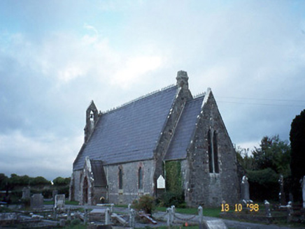 Ballyseedy ChurchChurch/chapel · 725 yd
 Ballyseedy Church (in ruins)Church · 732 yd
 Ballyseede Castle HotelCastle · 881 yd
 European Yew1006 yd
 Common Alder1087 yd
 Ogham stone in RatassOgham stone · 1.6 mi
_(27283083824).jpg/250px-Civil_War_Memorial._Church_St,_Ring_of_Kerry,_Cahersiveen_(506519)_(27283083824).jpg "Photo: Robert Linsdell from St. Andrews, Canada, Wikimedia Commons · CC BY 2.0") Civil War MemorialMemorial · 1.9 mi
Civil War MemorialMemorial · 1.9 mi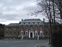 Kerry County MuseumMuseum · 2.4 mi
 Sonny McCarthy MemorialMonument · 2.4 mi
 Knockmichael MountainMountain / peak · 3.0 mi
 Tobar na MoltSpring · 6.0 mi
More archaeology and monuments in County Kerry · All of County Kerry
What do you know about this place?