What is recorded here
On a lower S-facing slope towards the foot of Slievenamuck mountain, surrounded by young forestry and c. 50m below a metalled forestry road. The area is heavily overgrown with brambles and scrub. According to a Coillte report this is a possible archaeological monument consisting of 'a field enclosure with a well defined earthen bank'. The area was replanted c. 1997/8 after clearfelling, however a buffer zone of 15m was to be left around the possible enclosure. The enclosure was not accessible at time of inspection due to the heavy overgrowth.
On a lower S-facing slope towards the foot of Slievenamuck mountain, surrounded by young forestry and c. 50m below a metalled forestry road. The area is heavily overgrown with brambles and scrub. According to a Coillte report this is a possible archaeological monument consisting of 'a field enclosure with a well defined earthen bank'. The area was replanted c. 1997/8 after clearfelling, however a buffer zone of…
From the National Monuments Service (Archaeological Survey of Ireland) record TS073-028
The monument record does not grant public access. Check the route and ask the landowner before entering private land.
- What survives
- Recorded monument
Places near here
Photo credits
- National Inventory of Architectural Heritage
- Colin Park, Geograph · CC BY-SA 2.0
- N Chadwick, Wikimedia Commons · CC BY-SA 2.0
- N Chadwick, Geograph · CC BY-SA 2.0
- kevin higgins, Geograph · CC BY-SA 2.0
- Graham Horn, Wikimedia Commons · CC BY-SA 2.0
- Willow, Wikimedia Commons · CC BY 2.5
Ballynacourty HouseCastle, unclassified · 557 yd Ballycrehane HouseHouse · 978 ydCatholic Church of the Sacred HeartChurch/chapel · 1203 ydBansha ForestForest · 1410 ydSlievenamuckMountain / peak · 1660 ydGlen of AherlowViewpoint · 2.1 miChrist the KingViewpoint · 2.1 miLough CurraWalking route · 2.5 miThe RockViewpoint · 2.7 miCushMountain / peak · 3.3 miThe Maid of ErinMemorial · 4.3 miEuropean ash6.5 mi
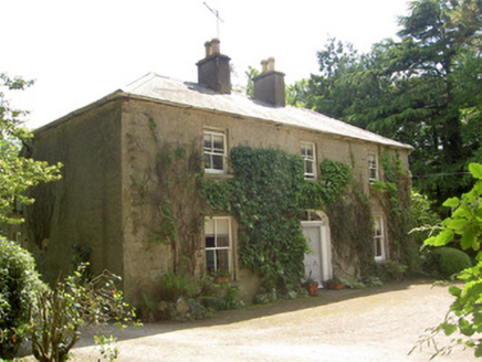 Ballycrehane HouseHouse · 978 yd
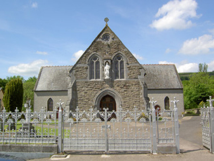 Catholic Church of the Sacred HeartChurch/chapel · 1203 ydBansha ForestForest · 1410 yd
 SlievenamuckMountain / peak · 1660 yd
 Glen of AherlowViewpoint · 2.1 mi
 Christ the KingViewpoint · 2.1 mi
 Lough CurraWalking route · 2.5 mi
 The RockViewpoint · 2.7 mi
 CushMountain / peak · 3.3 mi
 The Maid of ErinMemorial · 4.3 mi
 European ash6.5 mi
More archaeology and monuments in County Tipperary · All of County Tipperary
What do you know about this place?