What is recorded here
Aerial photos (CUCAP APH 77, 78, 79) show remains of possible enclosure and field system (OF011-023002-). Nothing visible on ground surface. Fields appear too regular to be old but enclosure also appears on aerial photo (GSI N453/4).
From the National Monuments Service (Archaeological Survey of Ireland) record OF011-023001
The monument record does not grant public access. Check the route and ask the landowner before entering private land.
- What survives
- Recorded monument
Places near here
Photo credits
- National Inventory of Architectural Heritage
- Dougbermingham ( talk ) ( Uploads ), Wikimedia Commons · CC0
- Kenneth Gallery Smyth, Geograph · Creative Commons Attribution-ShareAlike 2.0
- Douglas P.Bermingham, Wikimedia Commons · CC BY-SA 3.0
Field system in BallymoranField system · 153 yd Ballymoran HouseHouse · 1008 ydBallinla HouseFarm house · 1.1 miVictoria PlantationWood · 3.4 miVictoria PlantationWood · 3.5 miBlundell Castle (in ruins)Castle, tower house · 3.5 miDownan Grave YardGraveyard · 3.6 miClonin EarthworksMountain / peak · 4.0 miGrange CastleCastle, tower house · 4.6 miSli na Slainte - mapVisitor information · 4.6 miMountlucas Wind Farm Visitors CentreVisitor information · 4.7 miAllen family memorial headstoneMemorial · 4.7 mi
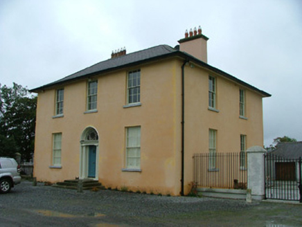 Ballymoran HouseHouse · 1008 yd
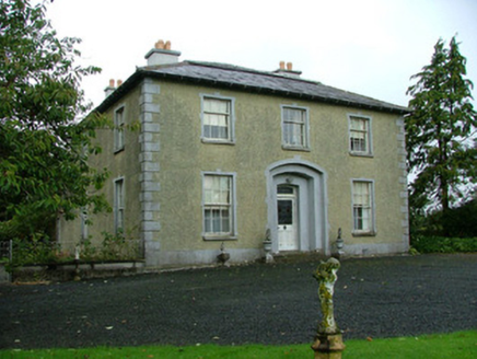 Ballinla HouseFarm house · 1.1 miVictoria PlantationWood · 3.4 miVictoria PlantationWood · 3.5 mi
 Blundell Castle (in ruins)Castle, tower house · 3.5 mi
 Downan Grave YardGraveyard · 3.6 miClonin EarthworksMountain / peak · 4.0 mi
 Grange CastleCastle, tower house · 4.6 miSli na Slainte - mapVisitor information · 4.6 miMountlucas Wind Farm Visitors CentreVisitor information · 4.7 miAllen family memorial headstoneMemorial · 4.7 mi
More archaeology and monuments in County Offaly · All of County Offaly
What do you know about this place?